Hiking Posts

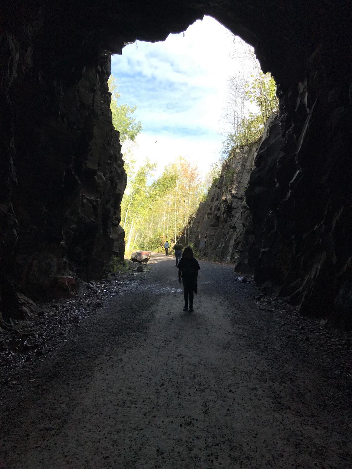
North Country Trail in Wisconsin: Backtracking

Seven years ago I began a quest to hike the North Country Trail across Wisconsin. Similar to my 20-year process of completing the Superior Hiking Trail in Minnesota, things are going slowly on the Sconnie side as well. In 2022 I completed just nine miles.

Despite my established reputation for tortoise-like hiking, I was determined to have a big year in 2023. Then I got busy with other things and ended up with exactly zero miles of NCT hiked that year.

I’ve already got one 2024 trek under my boots, but it kind of doesn’t count in terms of mileage. Which is why this chapter is titled “Backtracking.”

My only hike in 2022 began off Highway 53 on Holly Lucius Road, just south of Solon Springs. The previous chapter of my essay series concluded with a mistaken stroll on Highway 53, so I started my next hike by covering the path I should have taken at the end of my hike the year before. It wasn’t really backtracking, because I hadn’t walked this route yet, but it was a pause in my progression since it meant I would be arriving at Lucius Woods County Park for the second time.

PDD Quiz: Happy Trails to You

Lace up your boots and take a hike with this edition of the Perfect Duluth Day quiz, which highlights some local trails.

The next PDD quiz will review this month’s newsworthy events; it will be published on Sept. 24. Submit question suggestions to Alison Moffat at [email protected] by Sept. 20.

Interpretive signs will mark former Incline Railway sidewalk

The Duluth News Tribune reports the sidewalk and stairway that marks the location of the former Incline Railway at Seventh Avenue West, designated as a recreational hiking trail, will soon have interpretive signage.

The Slice: Hiking Kadunce River in Winter

In winter the Kadunce River, an 8.5-mile stream near Grand Marais that flows into Lake Superior about 100 miles northeast of Duluth, becomes a frozen hiking trail.

In its series The Slice, PBS North presents short “slices of life” that capture the events and experiences that bring people together and speak to what it means to live up north.

Selective Focus: John Keefover

John Keefover poses with the Northern Terminus sign after completing his thru-hike of the Superior Hiking Trail.

John Keefover is the Duluth-based nature photographer behind the photography business Keefography. This June, Keefover thru-hiked the Superior Hiking Trail, sharing photos, videos and journal entries along the way. Keefover used this adventure as an opportunity to raise funds for the Wolf Ridge Environmental Learning Center.

North Country Trail in Wisconsin: Green Undies in Gordon

There generally isn’t a lot to say about a good hike, nice weather and beautiful scenery. They are enjoyable, but they don’t help create a classic story one tells his friends about and sits down to record in an essay. Good stories involve things not happening as planned. Something must go very wrong, very right or very strange to have a good story. If someone shows up in green underwear, for example, it at least provides the foundation.

So before I write about the numbers and geography of my hiking, let me assure you that green undies are coming up.

If you’ve been following along on my North Country Trail in Wisconsin series, you know I’m slowly hiking 214 miles across the Badger State. I started in 2017 and as of this writing have completed 65 miles, taking my sweet time.

In the summer of 2020 I hiked from Pattison Park to the edge of the town of Gordon and ended part four of my essay series there. I thought I was done for the year, but just a few days after publishing the essay I headed back to Gordon for one more trek.

Spirit Mountain, Mission Creek trail link ready

A biker crosses the new Sargent Creek bridge on the DWP Trail Connector west of Ely Peak. (Photos by Mark Nicklawske)

A critical bridge is open, a tunnel has been repaired and work is nearly complete on a six-mile scenic trail that uses a former rail line to connect two large recreation sites on the west side of Duluth.

The city’s Parks and Recreation Division is in the final stages of improvements to the Duluth Winnipeg & Pacific Trail Connector which provides a direct link between the Mission Creek trail system in the Frederick Rodney Paine Forest Preserve and Spirit Mountain. A ribbon cutting on the $600,000 trail project is expected later this summer.

Makwa Ziibiins Miikana: Bear Creek Trail to Wisconsin Point

Last week Bear Creek Trail in Superior opened to hikers, bikers and snowshoers. It’s a 2.25-mile crushed-concrete pathway connecting the Osaugie Trail at Bear Creek Park to Wisconsin Point Road. An extension is in the planning stages that will create an additional trail on the other side of Wisconsin Point Road to parking lot #1. But what is already built is excellent.

Twenty Years on the Superior Hiking Trail: Ely’s Peak Loop

Paul Lundgren Saturday EssayThe laziest and slowest record in endurance-sports history has been broken. Again. By me. Again.

As documented in numerous essays, I started hiking the Superior Hiking Trail on Sept. 23, 2000 and finished the 310-mile trek from the Canadian border to Jay Cooke State Park on Nov. 5, 2015. Obviously I took a lot of breaks along the way. Then, in 2016, I hiked new parts of the trail that hadn’t been built when I first went through, thus breaking the record I already held for the slowest unsustained complete traverse of the Superior Hiking Trail.

Was that an official record? Well, no organizational body really keeps track of such things. But I stand firmly in my declaration that no one who has hiked the entire Superior Hiking Trail has taken longer to do it than me.

And now I’ve taken even longer.

In the summer of 2018 a new loop trail was built at Ely’s Peak in Duluth. It was kind of late in the hiking season when I heard about it, so I planned to do it in 2019. Then I kind of forgot about it and got distracted with other things. I had also started a new quest to hike the North Country Trail through Wisconsin. I’m still barely started on that.

Anyway, this past July I drove out to the Ely’s Peak area with the intention of knocking out the new last bit of trail, but as I started walking it occurred to me that if I waited until Sept. 23 to do this loop my Superior Hiking Trail story would span a perfect 20 years. So I hiked other trials that day and saved the loop for the perfect day.

Selective Focus: Superior Hiking Trail

The fall tradition of folks of hitting the 310+ mile Superior Hiking Trail continues. Featured here are select photos from Instagram.

North Country Trail in Wisconsin: Town of Summit

One nice thing about hiking on county roads is that if a deer fly is pestering you and you happen to walk by a freshly killed skunk, the fly will transfer to the skunk and leave you to hike in peace.

There are also fewer ticks on roads than on trails, and you are less likely to get lost. But the benefits of a trail instead of a highway are obvious and substantial. In particular: the natural beauty of the land is a bit less interfered with on a trail, there are no motorized vehicles to watch out for, and on hot days there is usually some protection from the blistering sun.

Those are the basic pros and cons as I hike through the town of Summit in my quest to follow the North Country Trail through Wisconsin. As I’ve explained in previous essays, the trail isn’t built yet in the area near the Minnesota border, with the exception of the Nemadji River Valley, so there is a road route connecting sections of the trail.

Last summer I hiked county roads W and B to Pattison State Park. So far in 2020 I’ve hiked from Pattison to the border between the towns of Summit and Gordon. All of this has happened without any overnight camping or serious day of dedicated hiking. It’s just casual car trips to walk the road in there-and-back stretches.

Most natural surface trails in Duluth now open

Woohoo! The city has opened most of its natural surface trails. Now we all get to figure out the dance required to stay six feet apart when meeting someone on those narrow trails.

Muddy Trails and COVID-19: Duluth Hiking in Spring 2020

Duluth’s Parks and Recreation division has released guidelines advising citizens how to use city parks and trails in a manner that will reduce the transmission of the COVID-19 virus. March and April are also the months when snow is melting and natural-surface trails can be easily damaged.

So, where is it OK to hike and how is it done safely?

Duluth Adventures: An Encyclopedia of Human-powered Multisport Adventures

I’ve been a bit obsessed with planning human-powered multisport adventures in Northeastern Minnesota. Even within Duluth city limits, the options for loops are nearly endless. I was curious if anyone else out there had done similar trips in the past. Then I thought about how cool it would be to have a documentation of many routes for others to explore, want to replicate, or spur their creativity for a new route/loop. And Duluth Adventures was born!

Check out duluthadventures.com. This website pretty much hinges on other people’s submissions so I strongly encourage anyone to navigate to the “submit” button and send in their own routes.

North Country Trail in Wisconsin: Crossing the Border

This is the third chapter in my quest to hike the North Country Trail across Wisconsin, but logistically it probably should be the first. As I’ve explained in previous chapters, the Superior Hiking Trail in Minnesota and the North Country Trail in Wisconsin aren’t properly connected yet at the border. The best thing a purist can do to fill the gap is hike on Minnesota State Highway 23 and a pair of county roads to get to a trailhead. So that’s what I did. Because I’m an annoying purist. Sort of.

It’s not so much that I’m determined to be annoying and pure. There are basically three reasons I wanted to hike on the roadways. 1) I know from experience that having a somewhat methodical goal inspires me to stay active. 2) If the pieces don’t all connect, it’s easy to lose track of where I’m at in the process, thereby thwarting reason #1. 3) Hiking on a trail in May is less fun anyway because of mud and ticks, so roads might be the best option anyway. (And if I were a true purist I’d strap on a backpack and hike across the whole state in a few days instead of breaking it up into numerous easy hikes.)

With all that in mind I parked my car on the side of Highway 23 near the Wild Valley Road sign and set out to connect my Superior Hiking Trail adventures to my fall 2018 North Country Trail hike at Nemadji River Valley.

Do NOT follow this link or you will be banned from the site!