
North Country Trail in Wisconsin: Wood Tick Flats
 You can’t — in the year 2017 — start hiking the North Country Trail at the border of Minnesota and Wisconsin without first hiking in from one direction or the other. If you want to go southeast through Wisconsin, for example, you need to start on Wild Valley Road in Minnesota and hike in for 3.2 miles.
I don’t know how far into Wisconsin you’ll get if you try that. As of the date of this post, the interactive map on northcountrytrail.org is unclear. It’s hard to tell if the trail ends cold in the woods, dumps out on a highway or carries on uninterrupted.
On the gorgeous Sunday afternoon of June 4, I tried to solve this mystery and failed. It was still a fun scouting mission, though, and that’s what I’ll share in this essay. Obviously I could call the trail association or maybe spend an hour scrolling through Facebook posts to obtain the knowledge I seek about the state of the trail, but I’d still want to see it for myself, so why bother with the hands-off research, right?
It has been thoroughly documented in a series of 14 essays on this very website that I slowly and somewhat methodically hiked all of Minnesota’s Superior Hiking Trail in sporadic spurts from 2000 to 2016. That journey started at the Canadian border and ended on the Wisconsin border. But the trail doesn’t stop at either of those points. The SHT is part of a much longer trail — the North Country National Scenic Trail — which extends to Lake Sakakawea State Park in North Dakota to the west and Crown Point in New York to the east.
My 16-year hike of more than 300 miles was just a short segment of a 4,600-mile monster trail. At the pace I’ve set so far, I’ll have it all done in the year 2246. It makes more sense to look at it in segments, of course, so the next logical goal should be to trek across the width of Wisconsin — a mere 200 miles or so.
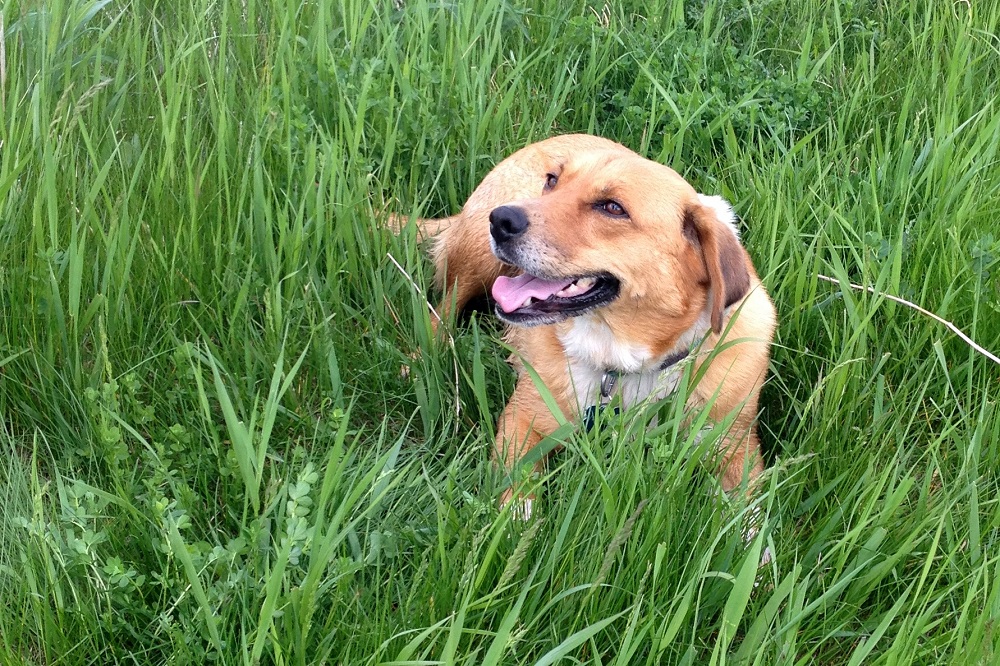
That’s the idea I had in mind when I sat down at my computer to look up trail maps and determine if enough of the western end of the North Country Trail in Wisconsin was fully built and ready for me. After a good 15 minutes of looking at the dotted red line on the map it became clear I was wasting my time. I needed to just get in the car and put eyes on it. So I jotted down some directions to MacQuarrie Wetlands in the Nemadji River Valley, rallied up my bride and my pooch, and off we went. The plan was to start there and hike back to the Minnesota border … or as far as possible.
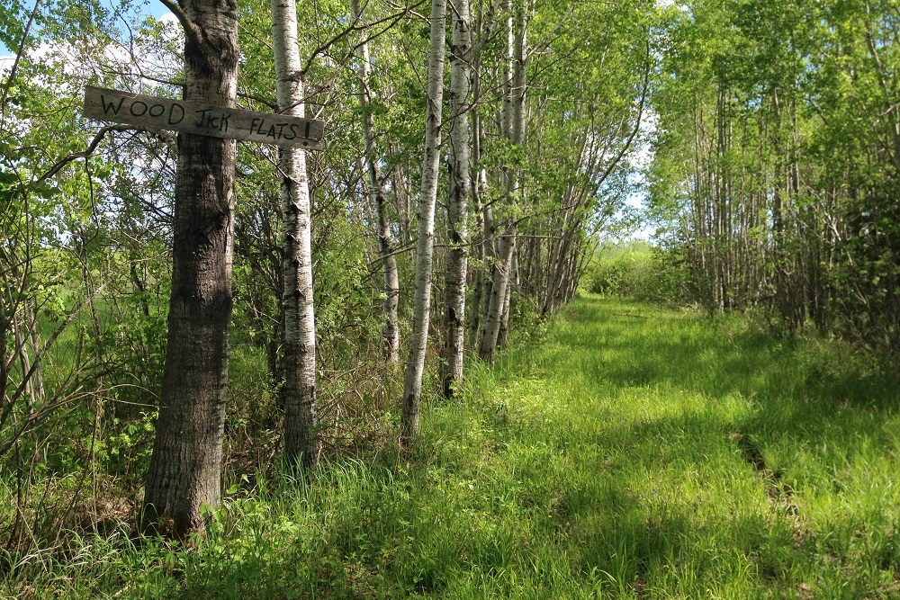
At the conclusion of the scenic drive across the Oliver Bridge and along various Douglas County highways we arrived at the end of a narrow, bumpy stretch of dirt called Hilpiper Road. Ours was the only car in a small parking lot near a trailhead kiosk. From there we could see trails going in three directions. The widest trail had a wooden sign nailed to a tree that read simply: “Wood Tick Flats!” The tall grass on the trail indicated the sign was no joke.
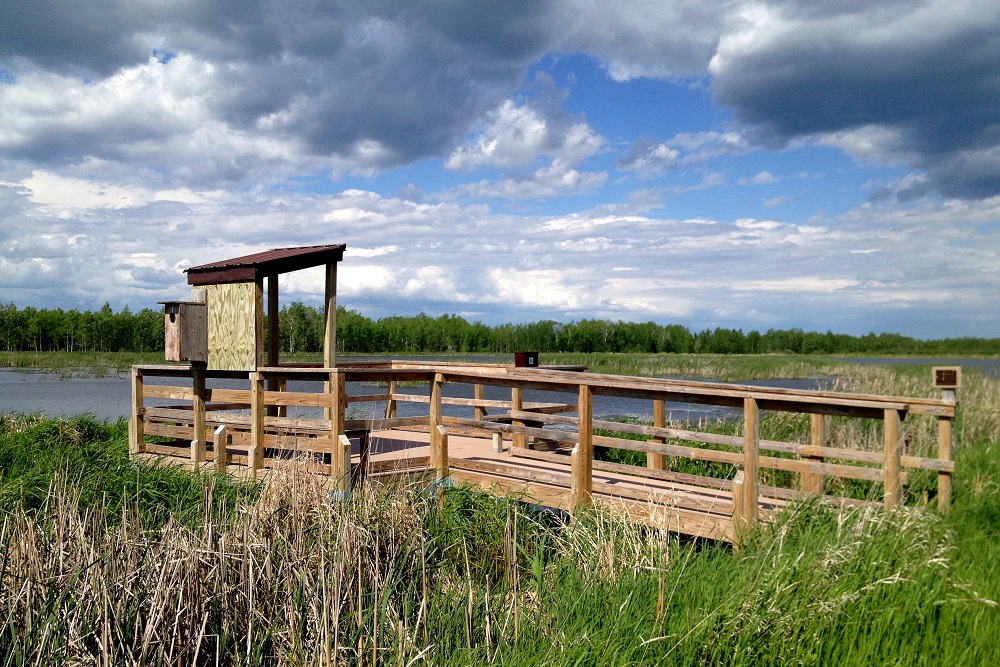
Since the tick trail was not given the respect of a line on the map, it was easy to eliminate that option. Our intended quest was to take the trail heading northwest, but it also looked a little overgrown, and we were curious about checking out the Oswald Viewing Platform, which was about a quarter-mile away in the opposite direction. So a-viewing we went.
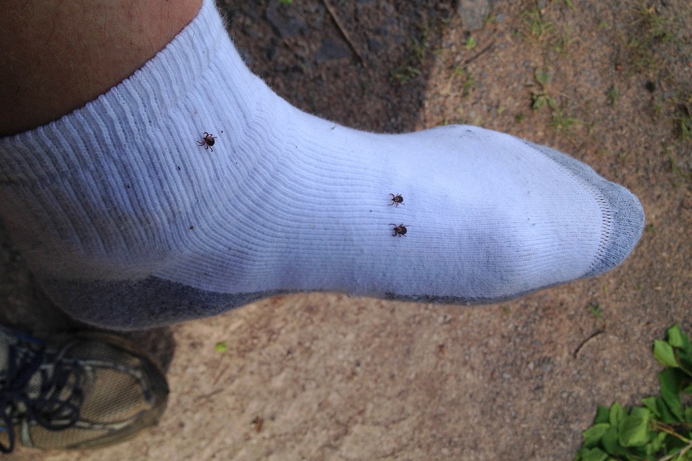
I quickly realized the impulsive side of me, eager to dive into another section of unseen trail, had led us to forget how many ticks are out in June and how the North Country Trail in Wisconsin is not necessarily as well manicured as the Superior Hiking Trail. Several ticks were plucked before we even made it the short distance to the platform.
It was worth it, though. The view from the platform and all around the river and its various ponds was impressive and the area was teaming with birds.
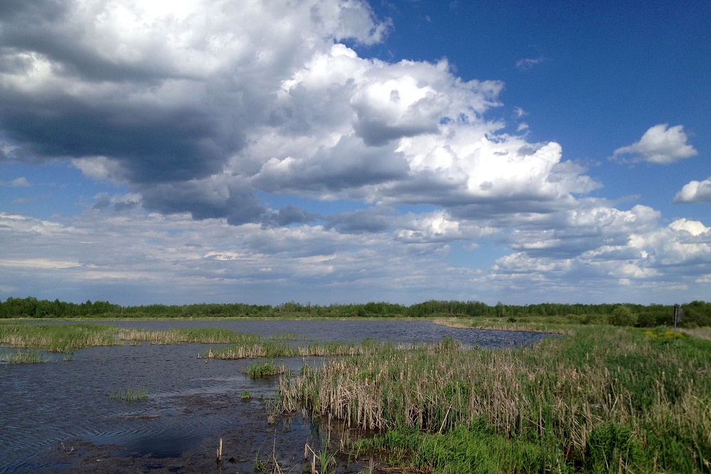
The wetlands are managed by the University of Wisconsin-Superior for research and outdoor recreation. The wildlife-viewing platform was built in 2015 by volunteers of the North Country Trail Association’s Brule-St. Criox Chapter. It’s named for the late Atley N. Oswald of Foxboro, a founding member of the association, who helped build and maintain parts of the trail and also built benches, signs and the aforementioned trail kiosk. A sign on the platform notes:
Atley was a man of many interests and talents. He loved hiking, nature, and being outdoors. Before there was an official North Country Trail, he hiked a Chequamegon National Forest trail from Iron River to Mellon. This was the original segment which gave birth to the concept of the North Country National Scenic Trail.
My decision to be impulsive and enter the North Country Trail somewhat blindly had suddenly turned into an education about the trail and a retreat from blood-sucking disease vectors. The NCT seemed overgrown in all directions, but we still walked around the edges of the ponds for nearly an hour. I accumulated 17 ticks. My wife and dog probably rivaled that, but they don’t keep count. For some reason I find that having numerous ticks scampering up my legs is made more fun when I can shout out numbers as I pull them off. “Hey, hey! Heeeere’s number eight!”
When we returned to the car it was time for a thorough strip search. I looked around for a garbage can, thinking the only safe thing to do might be to throw my shoes and socks away. Then again, we had to take the dog home with us anyway. Clearly we’d be finding new ticks all week.
North Country Trail in Wisconsin Index
Part 1: Wood Tick Flats
Part 2: Nemadji River Valley
Part 3: Crossing the Border
Part 4: Town of Summit
Part 5: Green Undies in Gordon
Part 6: Backtracking
Part 7: Returning to the Border
Part 8: Brule-St. Croix Portage
Nice exploring. Thanks for the essay.
Paul, glad you found your way to MacQuarrie Wetlands. We were a little behind on starting trail mowing this year, but the trail is now mowed and will continue to be on a three-week cycle for the rest of the growing season.
Up by the border, as you figured out, the trail is not complete on the Wisconsin side. We are awaiting a DNR approval and completion of an easement with Enbridge before we can build out to County Highway C. Between there and MacQuarrie, there’s still one more private easement in negotiation, too.
After you finish hiking MacQuarrie, the next segment is in Pattison State Park. And from there, head down to West Mail Road near Gordon, where you can get on the trail and hike all the way to Mellen and past Copper Falls State Park, well over 100 miles.
The “Wood Tick Flats” trail heads to a private hunting camp. A fitting name at this time of year.
Glad you saw some waterfowl. We think MacQuarrie is a special place more people will enjoy in the future.
–Peter Nordgren, trail maintainer, NCTA Brule-St. Croix Chapter, [email protected]
Thanks for the update, Peter. I will probably attempt some restraint and revisit the trail September. And thanks for all the work to make it happen!