North Country Trail in Wisconsin: Town of Summit
 One nice thing about hiking on county roads is that if a deer fly is pestering you and you happen to walk by a freshly killed skunk, the fly will transfer to the skunk and leave you to hike in peace.
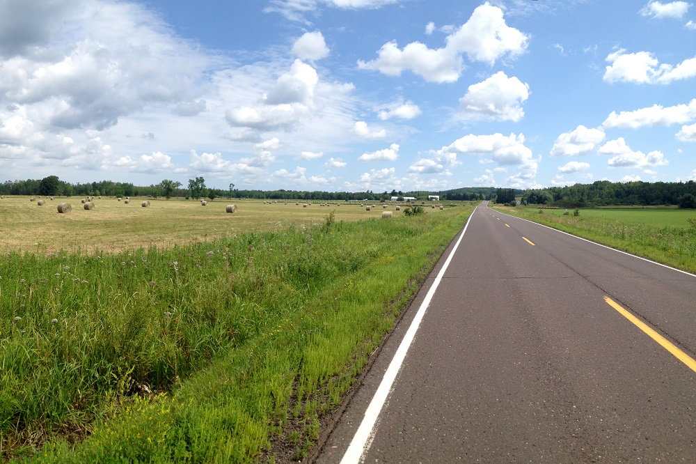
There are also fewer ticks on roads than on trails, and you are less likely to get lost. But the benefits of a trail instead of a highway are obvious and substantial. In particular: the natural beauty of the land is a bit less interfered with on a trail, there are no motorized vehicles to watch out for, and on hot days there is usually some protection from the blistering sun.
Those are the basic pros and cons as I hike through the town of Summit in my quest to follow the North Country Trail through Wisconsin. As I’ve explained in previous essays, the trail isn’t built yet in the area near the Minnesota border, with the exception of the Nemadji River Valley, so there is a road route connecting sections of the trail.
Last summer I hiked county roads W and B to Pattison State Park. So far in 2020 I’ve hiked from Pattison to the border between the towns of Summit and Gordon. All of this has happened without any overnight camping or serious day of dedicated hiking. It’s just casual car trips to walk the road in there-and-back stretches.
So I’ve been spending almost as much time in the car driving from Duluth to my hiking locations and back as I have on hiking. And I’ve covered just 30 miles of road/trail during 14 separate hikes over 13 months. It’s not efficient at all, but it keeps me inching onward in my quest.
During my summer 2019 hikes from the Nemadji River Valley to Pattison Park I covered 12 miles of road. Since each hike is a roundtrip, however, it was about 25 miles of walking totaling about eight hours, plus about seven hours of total driving. So, ironically, doing it the easy way requires much more effort. But the drive is fun.
This was before the pandemic, which meant I could stop at any of the numerous taverns in South Superior on my way home and erase my healthy behavior with a little booze and idle chit chat with the exotic locals of the strange land across the border.

The first stretch of the adventure is County Road W, which crosses through the Nemadji River Corridor, part of Douglas County Forest. I was walking there on July 6, thinking about how nice it is to not have to worry about ticks on the road, when … I mean, it seems unbelievable, but … I actually looked down at the grass on the side of the pavement and saw a tick hanging there, struggling to join me on my trek.
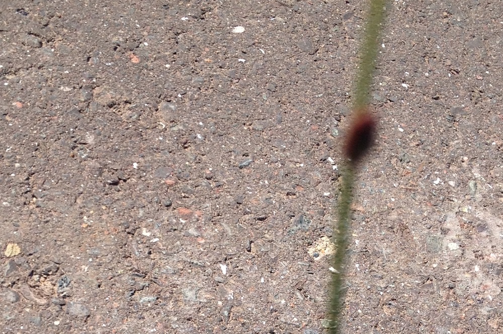
The camera on my old iPhone 4s couldn’t focus on an object that small, but I did my best to document the moment.

The main scenery on the road hikes consists of trees, wild flowers, houses, barns and trailers. Occasionally, however, one might come across the empty skin of a squashed frog on the gravel.
![]()
On one drive to the start of a hike I pulled over to eject a compact disc and adjust the radio. At that moment a golden eagle flew over the car in a moment of silence. Then KUMD popped on with some psychedelic reggae song that seemed like it was chosen by the Fates as theme music for the moment.
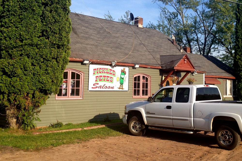
Among the places on Wisconsin Highway 35 to stop for a post-hike beverage on the drives home are the Manitou Inn, Bucktails, Shortstop and Pickled Pete’s. Variety is the spice of life.
A short section of my 2019 trek included a 2.5-mile stretch of ATV trail, otherwise it was all road-walking from the Nemadji River Valley to Pattison Park.
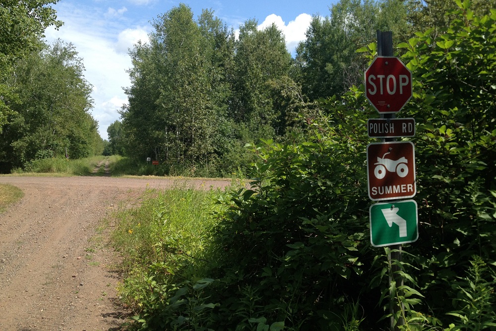
Hey, did you hear the one about Polish Road? It’s a dead end because ethic jokes aren’t funny anymore.
County Road B is the home stretch to Pattison Park. From the road there are many nice rural residences. It’s easy to be completely unaware that there are several dumping grounds nearby. The following summer is when I noticed an access from the other direction — Landfill Road. I like to call it Landfill Lane. Has more of a ring to it.
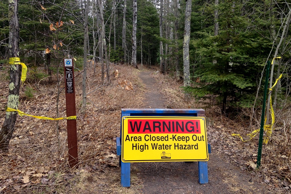
Toward the end of summer — Sept. 7 to be precise — I arrived at Pattison Park to discover the section of the North Country Trail that passes through there was closed. The Father’s Day Flood of 2018 wrecked parts of it.

Pattison offers a few other trails, however, so I called an end to my methodical hike for 2019 and simply strolled around the highest waterfalls in Wisconsin.
When I resumed my quest in 2020, the pandemic was in full swing. My first hike was on April 23. I visited the opposite end of the closed section of trail at Pattison to verify it was still closed. The park was open, however, with COVID-19 safety signs indicating entry fees were waived. Free parking! Thank you, pandemic … I guess.
I resumed my highway hike down Wisconsin 35. There was probably less traffic due to the shutdown of businesses and people working from home, but I had no previous walking experience on that road for comparison.
On my next hike I worked my way down East Milchesky Road. I noticed something odd there that I won’t use photos to illustrate because I don’t want to call anyone out by identifying the properties. I just want to mention it because I can’t figure it out. Some roads I’ve hiked have a lot of litter on them, and others do not. East Milchesky, for the most part, was pretty free of trash. There are a number of homes along the road, and most of them had no loose garbage at all. One house had all kinds of furniture, appliances, spray-painted tires and other junk strewn around in an eccentric manner, but no garbage at all. And then directly across the road was a modern-looking house, well kept, with a nice barn. And on the side of the road in front of it was a mess of plastic refuse — mostly big, empty Gatorade and Dasanti jugs, but also motor oil and other auto products.
Why was all the garbage on that road loosely clustered in front of one house on an otherwise neatly kept property? I can only imagine that someone who lives there has an enemy up the road who drives by daily and tosses whatever he has out the window in contempt. But there is probably some more creative fiction I can come up with to explain it. Maybe it’ll get its own essay some day.

In the Amnicon Lake area the “trail” turns down County Road A. The number of “Private Property” and “No Trespassing” signs begin to increase, along with the Trump flags, but there are also some silly things like a shiny yellow shirt hung over a sign, with a smiley face drawn on it and a welcoming message noting the driveway is near. There’s also a painted sign at another property noting the path approaching the house is “Humdrum Drive.”
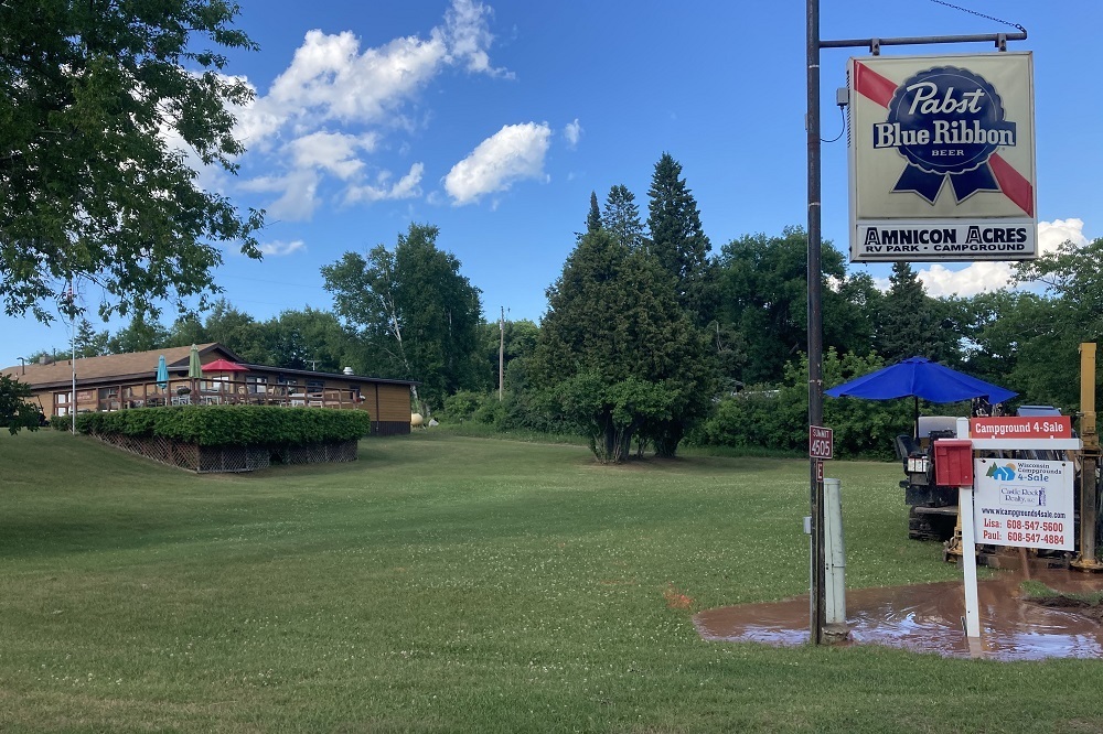
As the summer continued, Wisconsin bars opened back up, but as much as I enjoy slowly killing myself with alcohol, the more immediate threat of a suffocating virus led me to avoid most of my post-hike pit stops. I did find one outdoor drinking establishment, however, at Amnicon Acres.
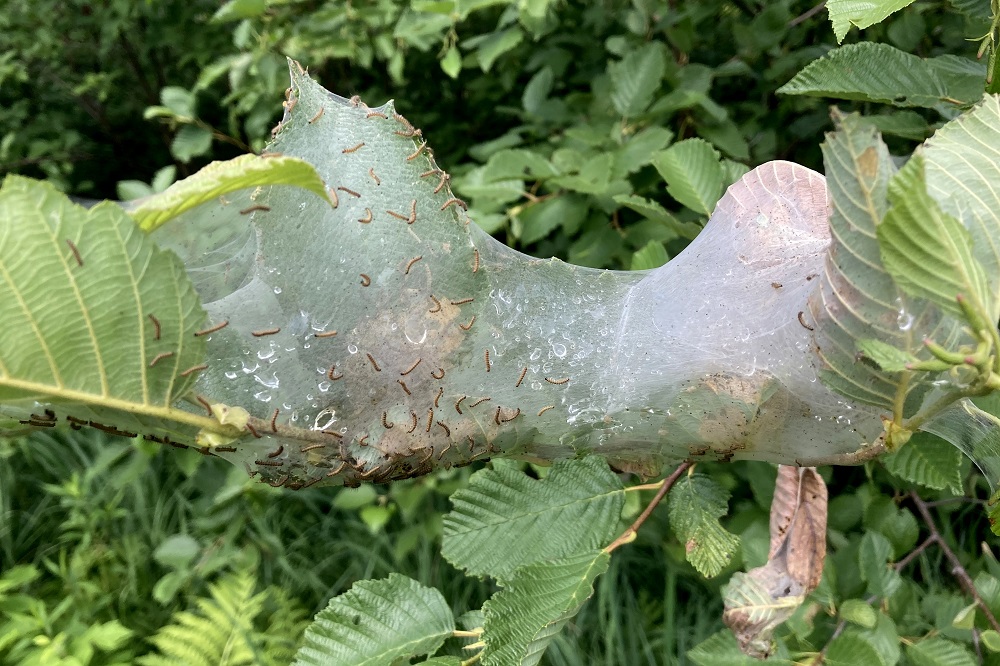
As I continued down Highway A in mid-July there were at least three spots where eastern tent caterpillars were tenting. They are different than the dreaded forest tent caterpillars that defoliate trees. There hasn’t been an infestation of the foliage-gorging maniacs since 2002, but the appearance of their similar-looking cousins always reminds me of the horror. And I’m sure some legit tent caterpillars were lurking out there in small numbers.
While “army worms” weren’t rising to the level of pests on this hike, the absence of a roadkill skunk to transfer flies left me walking the rural highway slapping myself on the back of the head like a mentally disturbed person enraged about his own stupidity. That’s generally the impression I leave on any community I visit, so let’s call that normal.
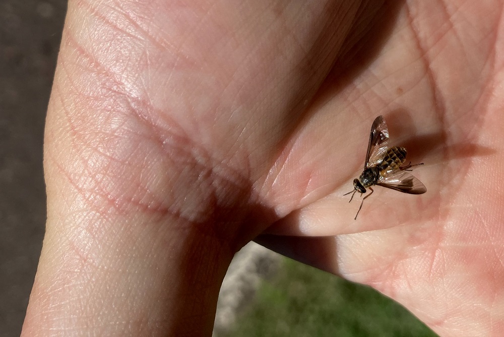
Having dropped my old iPhone 4s in the sink back in April, I was now toting a new iPhone SE, allowing for better insect photos.
The border of the towns of Summit and Gordon is marked with signs in either direction that inform the public of import things about each municipality. Departing Summit: “Mobile home parking permit required by order of town board.” Entering the next adventure: “Town of Gordon is zoned, permits required.”
It kind of sounds like an expression you’d hear from a 22-year-old. “Have you been to Gordon? Dude, that town is zoned.”
Anyway, I still have about 16 miles of roadway to hike before I get to the next section of trail near the St. Croix River. But this essay concludes with some backtracking to Pattison. In August I returned to the park, where the North Country Trail section had recently been restored, complete with new pedestrian bridges, creating a luxurious footpath to Little Manitou Falls. The project cost $1 million.

Million dollar trail, million dollar view.
North Country Trail in Wisconsin Index
Part 1: Wood Tick Flats
Part 2: Nemadji River Valley
Part 3: Crossing the Border
Part 4: Town of Summit
Part 5: Green Undies in Gordon
Part 6: Backtracking
Part 7: Returning to the Border
Part 8: Brule-St. Croix Portage
Brilliant! A hilarious addition to a very readable and interesting essay. Made my morning!