North Country Trail in Wisconsin: Nemadji River Valley
 If you’ve ever hiked Minnesota’s Superior Hiking Trail to the Wisconsin border you know the trail ends there, but doesn’t really end there. Despite a sign on a tree that reads “Southern Terminus of SHT” and a separate post sticking out of the ground that reads “Not a trail,” there is clearly a trail there leading into Wisconsin. But it doesn’t go far.
The rest of the text on the terminus sign explains: “Spur trail from here to be built by North Country Trail to a parking lot in WI. Trail now dead-ends ahead.”
I explained all that 17 months ago in a Saturday Essay titled: “North Country Trail: Wood Tick Flats,” which was the first report on my quest to hike the North Country Trail across Wisconsin. That summer I covered exactly zero miles on the trail, which is not a great start to a 200-mile journey. If you read that first North Country Trail essay from June 2017 you know I didn’t hike on the trail that day because the grass was long and loaded with ticks. So I waited and saved the hike for a day with more favorable conditions … 17 months later.
What I lack in ambition I make up for with tenacity, right? My motto is: “Never quit. Take a nap and try again later when you feel more up to it.”
There are roughly 120 miles of North Country trail in Wisconsin, and the roadways and temporary routes that connect those official trail sections make up another 80 miles. This year I hiked four miles, so my pace has really picked up.

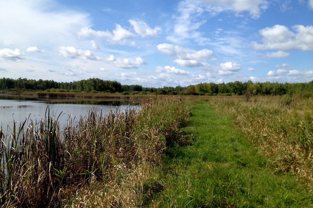
I finally returned to the Nemadji River Valley on Sept. 30, 2018. The gate on the way to the parking lot at Gordon MacQuarrie Memorial Wetlands was closed and locked, but there’s a North Country Trail spur on the side of the road a few hundred feet before the gate with room to park. It was a dry, sunny Sunday, and I was finally ready to get some miles in.
After a bit of map study, some time putting my eyes on things and an explanation from someone in the know, I now have a pretty solid understanding that there is a roughly 5-mile gap between where the trail ends at the Minnesota border and where the North Country Trail picks up in Wisconsin. Easements with the energy distribution company Enbridge and a private landowner need to be sorted out before the trail at the border connects to MacQuarrie Wetlands.
Setting aside all the logistical blahbidyblah about how to plan out a long hike in short segments, the thing I can communicate to any casual hiker is this:
Go visit MacQuarrie Wetlands and hike the trails there. It’s fantastic … when tick season is over. In addition to the North Country Trail there are numerous other trails that wrap around the various marshy ponds in the area. It’s located at the end of Hilpiper Road, which is just off Douglas County Road W — about a 25-mile drive from Downtown Duluth.
Hiking the North Country Trail at MacQuarrie Wetlands can be approached numerous ways, but the obvious choices are to park in the middle of the trail and hike in either direction and back, which means the three miles of trail turns into six with the doubling up to return. It’s possible to park on county highways at either end of the trail, but that’s not a better option unless you have a car at each end, and you probably don’t want to bother with that.

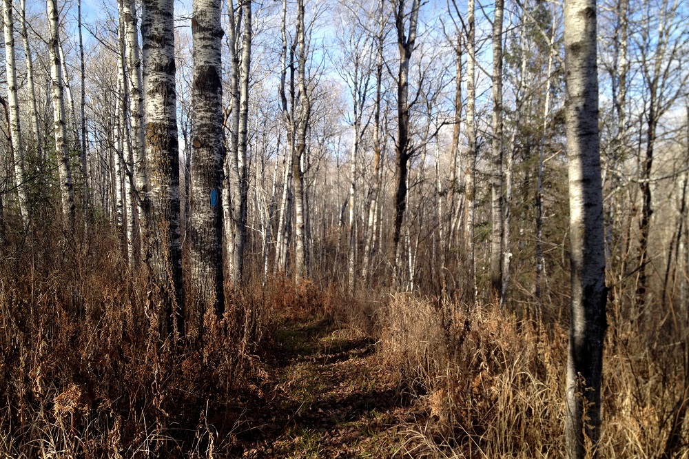
I opted to hike half the trail on Sept. 30, then returned Nov. 1 to do the other half. Both hikes are similar in that they begin in the open wetland and lead away into a forest. If you try this yourself, I recommend taking a moment to orient yourself with the map posted in the parking lot, rather than giving it a quick glance. The way the map is positioned makes it easy to interpret backward. Specifically, when you are looking at it you’ll see the Oswald Viewing Platform to the east, which is to your right on the map and to your left in reality.
My first hike was the 1.4-miler in the northwest direction, with the option to add bonus miles going north on the Saunders State Trail (aka Soo Line South ATV trail). I opted to hike some of bonus trail, but it was flooded near County Highway C, and signs were posted at the highway indicating it was closed due to flood damage from earlier in the summer. Still, with the added distance the round trip came in around four miles — which is a nice length for a simple day hike.
After a rainy October I returned for the 2.6-mile section, which of course is a bit more than five miles roundtrip and takes about two and a half hours to leisurely stroll with time allowed for watching beaver swim, etc. I missed fall colors completely, so my first hike was a green one and my second hike had surroundings that were more of a yellowish brown. Crisp late-fall hikes, even though the trees are largely defoliated, are still some of the best in my opinion.
So now my journey has really begun. I’ve made it something like one-fiftieth of the way to Michigan. Stay tuned for chapter three, probably next summer.
North Country Trail in Wisconsin Index
Part 1: Wood Tick Flats
Part 2: Nemadji River Valley
Part 3: Crossing the Border
Part 4: Town of Summit
Part 5: Green Undies in Gordon
Part 6: Backtracking
Part 7: Returning to the Border
Part 8: Brule-St. Croix Portage
I’m inspired…to take a nap and try again tomorrow. Thanks, Paul.