Trails
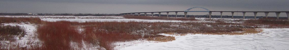
Minnesota’s Mountain-biking Trail Boom
Minnesota Public Radio reports that professional builders have constructed more than 100 miles of mountain-biking trails in northeastern Minnesota in the past five years.
Spirit Mountain, Mission Creek trail link ready
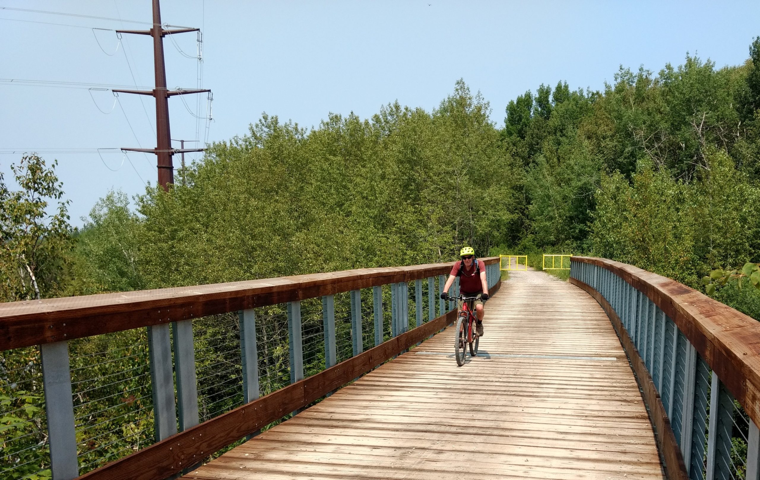
A biker crosses the new Sargent Creek bridge on the DWP Trail Connector west of Ely Peak. (Photos by Mark Nicklawske)
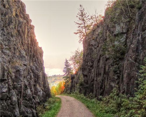
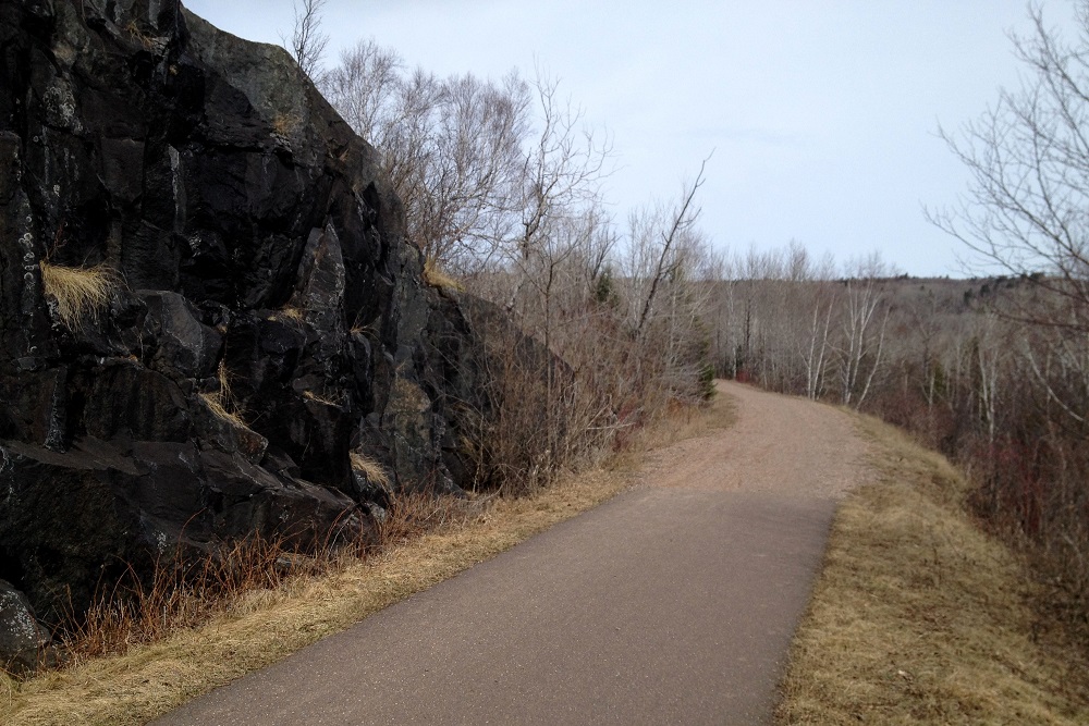
A critical bridge is open, a tunnel has been repaired and work is nearly complete on a six-mile scenic trail that uses a former rail line to connect two large recreation sites on the west side of Duluth.
The city’s Parks and Recreation Division is in the final stages of improvements to the Duluth Winnipeg & Pacific Trail Connector which provides a direct link between the Mission Creek trail system in the Frederick Rodney Paine Forest Preserve and Spirit Mountain. A ribbon cutting on the $600,000 trail project is expected later this summer. (more…)
Makwa Ziibiins Miikana: Bear Creek Trail to Wisconsin Point
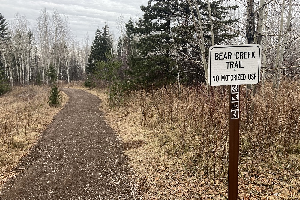
Last week Bear Creek Trail in Superior opened to hikers, bikers and snowshoers. It’s a 2.25-mile crushed-concrete pathway connecting the Osaugie Trail at Bear Creek Park to Wisconsin Point Road. An extension is in the planning stages that will create an additional trail on the other side of Wisconsin Point Road to parking lot #1. But what is already built is excellent. (more…)
Muddy Trails and COVID-19: Duluth Hiking in Spring 2020
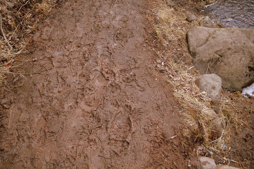
Duluth’s Parks and Recreation division has released guidelines advising citizens how to use city parks and trails in a manner that will reduce the transmission of the COVID-19 virus. March and April are also the months when snow is melting and natural-surface trails can be easily damaged.
So, where is it OK to hike and how is it done safely? (more…)
Western Waterfront Trail will share corridor with excursion train
The Duluth News Tribune reports a plan has emerged to extend Duluth’s Western Waterfront Trail via a rail corridor, while maintaining a scenic train service that would continue to use the same route. The proposed future name of the trail is “Waabizheshikana” — pronounced: waa-bah-zhay-kuh-nuh — meaning “Marten way, path or road.” (more…)
Maxxis Tires visits Duluth
Maxxis Tires, a manufacturer of a variety of tires, including bike tires, sent cyclist/videographer Brice Shirbach to Duluth to show off the world-class bike trails. (more…)
There is no Poop Fairy PSA
You may have seen signs and literature around town encouraging pet owners to pick up after their pooches. Here’s a PSA for the campaign. Sponsored by Duluth Park and Recreation Department, along with the Regional Stormwater Protection Team.
With Jenna Kelly and Jody Kujawa, video by Danger Bird Productions
Annual reminder: Stay off muddy trails in spring
Duluth’s Parks and Recreation Division has put forth its annual reminder that all natural-surface trails are closed until further notice due to wet soil conditions from the annual spring thaw.
So, where should people hike in April? (more…)
North Country Trail in Wisconsin: Nemadji River Valley
 If you’ve ever hiked Minnesota’s Superior Hiking Trail to the Wisconsin border you know the trail ends there, but doesn’t really end there. Despite a sign on a tree that reads “Southern Terminus of SHT” and a separate post sticking out of the ground that reads “Not a trail,” there is clearly a trail there leading into Wisconsin. But it doesn’t go far.
The rest of the text on the terminus sign explains: “Spur trail from here to be built by North Country Trail to a parking lot in WI. Trail now dead-ends ahead.”
I explained all that 17 months ago in a Saturday Essay titled: “North Country Trail: Wood Tick Flats,” which was the first report on my quest to hike the North Country Trail across Wisconsin. That summer I covered exactly zero miles on the trail, which is not a great start to a 200-mile journey. If you read that first North Country Trail essay from June 2017 you know I didn’t hike on the trail that day because the grass was long and loaded with ticks. So I waited and saved the hike for a day with more favorable conditions … 17 months later.
What I lack in ambition I make up for with tenacity, right? My motto is: “Never quit. Take a nap and try again later when you feel more up to it.” (more…)
North Country Trail in Wisconsin: Wood Tick Flats
 You can’t — in the year 2017 — start hiking the North Country Trail at the border of Minnesota and Wisconsin without first hiking in from one direction or the other. If you want to go southeast through Wisconsin, for example, you need to start on Wild Valley Road in Minnesota and hike in for 3.2 miles.
I don’t know how far into Wisconsin you’ll get if you try that. As of the date of this post, the interactive map on northcountrytrail.org is unclear. It’s hard to tell if the trail ends cold in the woods, dumps out on a highway or carries on uninterrupted.
On the gorgeous Sunday afternoon of June 4, I tried to solve this mystery and failed. It was still a fun scouting mission, though, and that’s what I’ll share in this essay. Obviously I could call the trail association or maybe spend an hour scrolling through Facebook posts to obtain the knowledge I seek about the state of the trail, but I’d still want to see it for myself, so why bother with the hands-off research, right?
It has been thoroughly documented in a series of 14 essays on this very website that I slowly and somewhat methodically hiked all of Minnesota’s Superior Hiking Trail in sporadic spurts from 2000 to 2016. That journey started at the Canadian border and ended on the Wisconsin border. But the trail doesn’t stop at either of those points. The SHT is part of a much longer trail — the North Country National Scenic Trail — which extends to Lake Sakakawea State Park in North Dakota to the west and Crown Point in New York to the east. (more…)
Trails, trails, trails.
Let me open with: I’m an overweight man who wonders whether he’s being dishonest when he clicks “stocky” on dating websites. I’m not a hiker. I’m an occasional walker-off-pavement.
A story about paving the Minnesota River Bottoms trail in the Twin Cities makes me think about trails in Duluth and about trails in general. Apparently, paving a trail is very expensive, and for that reason, people don’t want to do it. (more…)
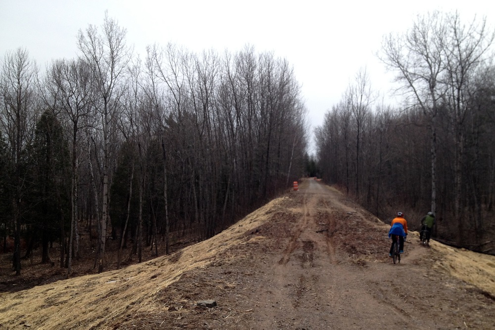
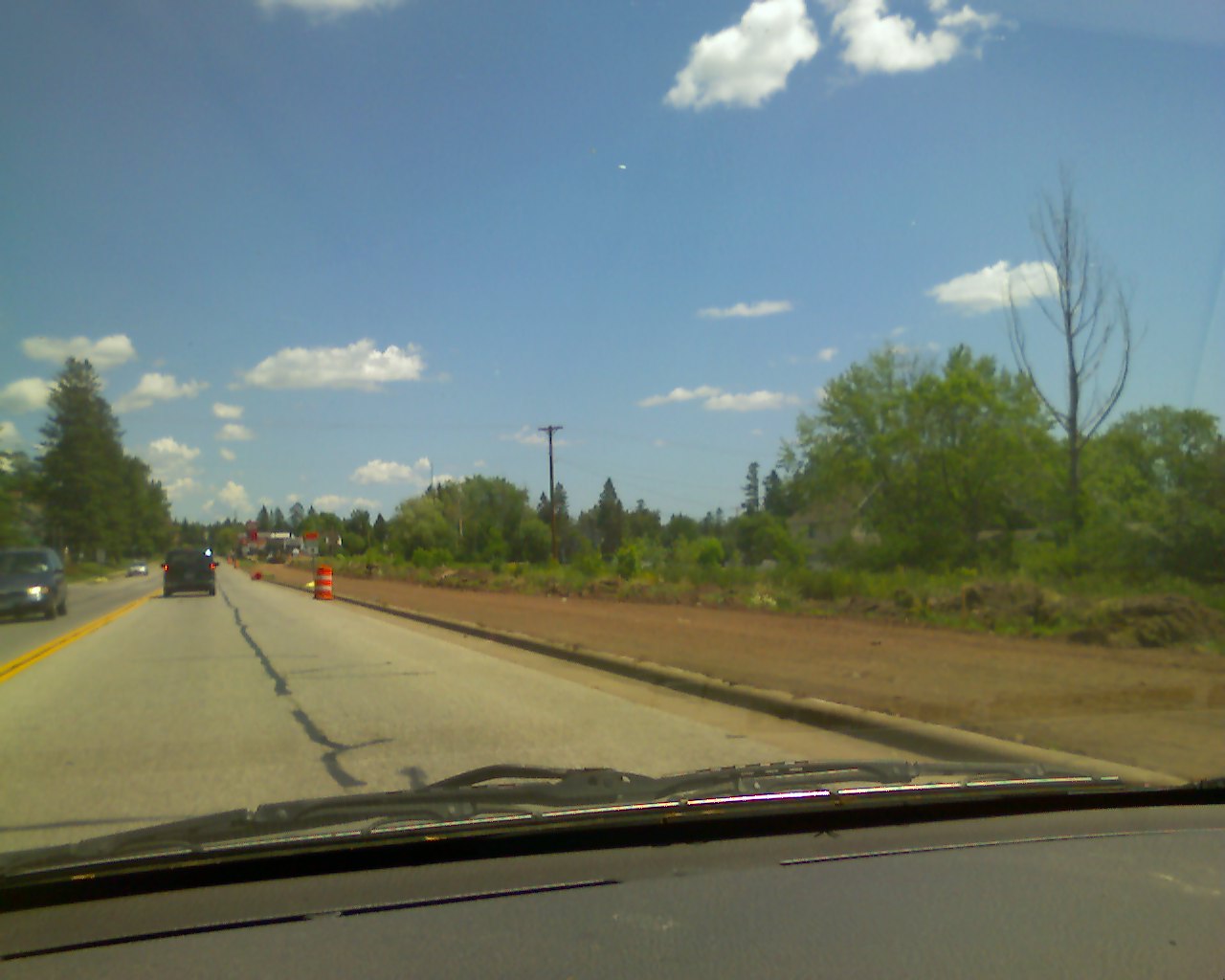
Duluth portion of Munger Trail to close for construction
 A 5-mile stretch of the Willard Munger State Trail between Grand Avenue and Becks Road in western Duluth will be closed for an extensive construction project from mid-April through August, according to the Minnesota Department of Natural Resources.
The project will stabilize parts of the treadway damaged during the Historic Solstice Flood Disaster of 2012 and bring that section of the trail up to current standards that call for a wider surface and shoulders. Because heavy equipment will be operating in the area, the section of the trail will be closed to all traffic throughout the project.
The Munger Trail is a collection of three trail segments accommodating multiple uses, including bicycling, walking, horseback riding and snowmobiling. The 70-mile Hinckley–Duluth segment is completely paved — other than the damaged areas — and passes through three state forests and Jay Cooke State Park.
Below are images from spring 2017 showing damaged sections of the trail in Duluth.
Public comment sought on EAW for Spirit Mountain projects
 The city of Duluth is accepting public comments until July 13 on an environmental assessment worksheet that was prepared for proposed projects at Spirit Mountain Recreation Area in 2016-2017. The plans include Nordic cross-country ski trails, mountain bike trails, Superior Hiking Trail extensions, rail-to-trail conversion, and an 18-hole disc golf course.
The proposed projects would initiate when all permits and approvals are received. They are part of the St. Louis River Corridor Initiative aimed at revitalizing and enhancing recreational opportunities and appropriate development in the western corridor of Duluth. (more…)
Paved Trails at Hartley
I was out at Hartley Park this morning and saw that someone had posted signs letting visitors know that the city is considering paving a bunch of trails there. I looked up the mini master plan for Hartley that SRF Consulting Group prepared, and it does indeed call for paved trails running through the park to provide access for bikers, wheelchairs, and parents with strollers. I’m curious about what other PDDers think of this proposal.
Lakewalk extension
Anybody who lives in Lakeside has presumably figured this out by now, but others may be interested to learn that construction on the latest phase of the Lakewalk extension–from 47th to the highway– appears to be rolling along. It looks like the section nearest to 47th may take a little more preparation than the rest due to the slope, but the part farther east might be pretty close to ready for pavement. Based on the work the past couple summers, it doesn’t seem too farfetched to think they’ll be done before fall.