Sixteen Years on the Superior Hiking Trail: Loss and Lost
 Hiking through the Castle Danger area in 2013 I came to a sign informing me the Encampment River Bridge was out. No big deal, I thought. I’ll hike elsewhere and pick up this section next year.
To this day there is no Encampment River Bridge. It was washed out in the Historic Summer Solstice Flood Disaster of 2012, along with about $50 million worth of other stuff in northeastern Minnesota. What I found out by talking to other people who had hiked through the area is the Encampment River is not typically deep and gushing, so unless there’s been a heavy rain it’s easy to cross without a bridge.
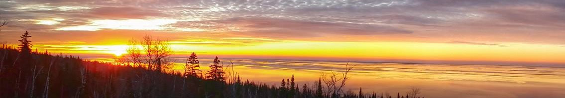
With that knowledge I made plans for my final hike of 2014, from Silver Lake Township Road 617 at Castle Danger to Lake County Road 301. Saturday, Oct. 11, looked good on my calendar as one of the last days one might confidently expect nice weather before colder days set in.
Of course, there are forces other than weather and natural disasters aligning to alter whatever plans we might have for our lives. Six days before my hike, a great friend and mentor died in his sleep.
Mike Simonson, longtime KUWS radio news director and Superior bureau chief for Wisconsin Public Radio, was an influential journalism instructor at the University of Wisconsin-Superior, where I graduated in 1996. He was the kind of teacher who led by example and demanded the best of his students. His death was a crushing blow to everyone who knew him.
My respect for Mike was always greater than my will to follow in his footsteps, probably because of an unyielding joker-and-slacker side of my personality that takes over whenever hard work and seriousness occur for more than eight consecutive minutes. So I wasn’t one of his primary protégés who excelled in the KUWS news department under his wing and went on to work respectably in mainstream media. Instead I hosted the evening jazz and late-night alternative music shows and in between played the “News at Nine” tapes produced by Mike and his students. I did B-level work in his classes. It was clear I wasn’t cut out for Edward R. Murrow awards. But Mike and I maintained a loose friendship over the years anyway, perhaps because in addition to being a bulldog journalist and dedicated teacher, he was also a regular West Duluth guy who fit right in at the North Pole Bar and had his own comic wit, though he always managed to keep those latter things in check much better than I.
After college I went on to work in Duluth’s alternative and freelance news circuit, eventually leading to my role as Grand Poobah of a silly little culture website called Perfect Duluth Day. Throughout all of that, there was still no stronger mentor than Mike Simonson, despite the fact that we never worked that closely. Lectures from two classes taken two decades ago, listening to him on the radio and things he said over drinks every 15 months or so were enough to steer me in profound ways.
My body of work in the journalism field doesn’t compare well against Mike’s, but, as much as I try to run from it, it turns out I do have a strong work ethic and a thirst for truth, partially instilled from observing the man in action. I don’t know if he ever knew that, but I do think he appreciated my unconventional approach to things. I know 18 years later he still laughed out loud recalling the time twenty years ago when he tuned in to listen to his prerecorded evening newscast and then I came on the air after it to play Camper Van Beethoven’s “Take the Skinheads Bowling.”
Mike’s funeral was held the Saturday morning of my planned hike, and each eulogy sent my mind in a different direction. I figured a trek through the woods would be the best way to process it all. Because my mind wasn’t on the task of hiking, however, I made a few mistakes in my preparation. I didn’t bring a map. I didn’t bring a phone. I took for granted that I was going on a simple hike from one parking lot to another, and all I had to do was stay on the trail until I reached my destination.
My wife Stephanie drove the car, and we had a simple plan. We’d park at the Silver Lake Township Road 617 trailhead and hike together for a while, then she’d hike back to the car, drive to the parking lot at Lake County Road 301 and either meet me there or hike in and find me. A friend had been through this section a week before, so we were confident crossing the Encampment River would not be a problem.
I left my phone behind intentionally, because I’d hiked more remote areas in previous weeks and didn’t have reception out there. That’s flawed logic, of course, because I probably would have had cell service in this location. I left the trail guide behind so Stephanie would have a road map to find the parking lot. All I needed to do was keep hiking until I got to her car, so why hike with a book? In retrospect I should have brought my pocket map, but again, why would I need it?
It was later in the day than I would normally begin a hike like this, due to the morning funeral, the 40-minute drive and earlier sunset of the season. Still, I had plenty of time to complete a 6.3-mile hike, and it was a gorgeous day.
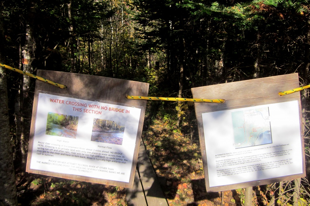
Despite the warning signs about crossing the river, we didn’t worry about it at all. It just didn’t seem worth bothering to put together a backup plan in case somehow I couldn’t cross. We were confident we had good intel.
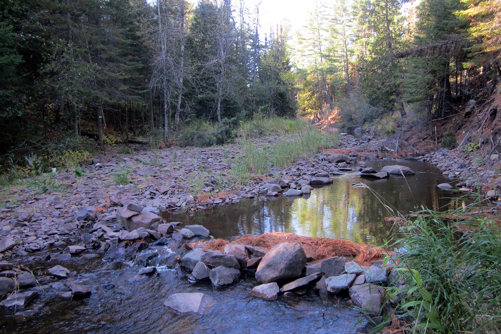
A mile or so after Stephanie turned around, there it was, the Encampment River, with a pile a stones as a makeshift bridge over mere inches of water stretching fewer than ten feet. I’ve had more difficulty crossing Duluth streets and hopping over potholes.
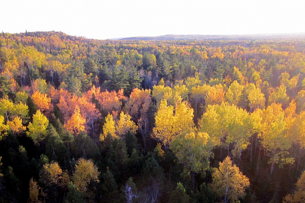
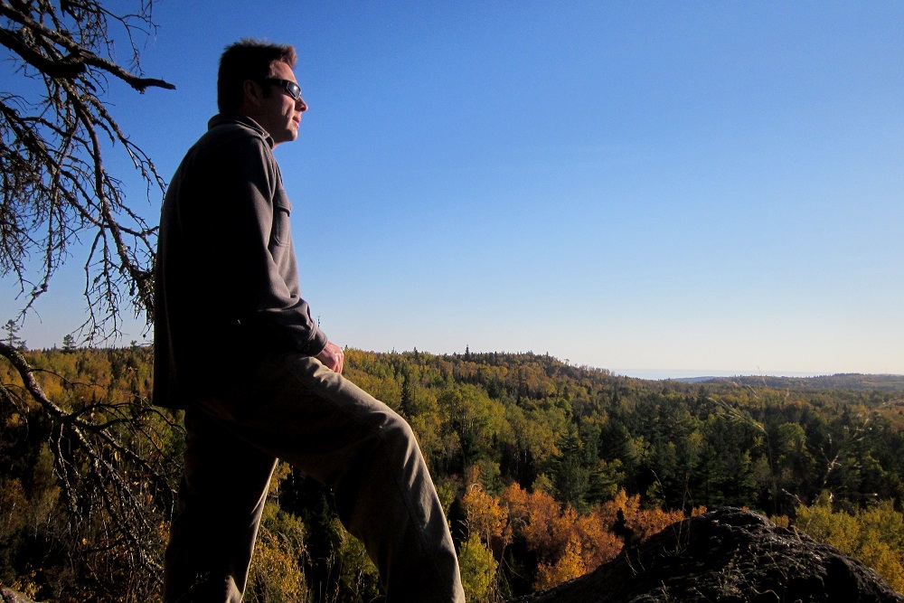
With all potential danger behind me, I marched confidently along the trail. A little more than a mile later I reached the Pine Ridge Overlook and spent maybe twenty minutes there, looking out at the red pines and spruce trees, thinking about my life, Mike’s life, and the ways they intersected and diverged.
I continued the hike still deep in thought. After a little more than a mile I came to a river. It looked familiar. It looked like the reverse view of the Encampment River. There was even a rocky bridge that … well, you can see where this is going. I had resumed my hike in the wrong direction, went back the way I came and returned to the Encampment River.
This was not a major problem. Yes, it would set my arrival time back an hour or so, but I wasn’t lost and there was still plenty of daylight left. I picked up my pace and marched along the path I’d already trod twice, now finally on my merry way to County Road 301.

Eventually I came to a road and sign. Had I arrived at my destination? No. The sign indicated the parking lot was 1.9 miles up the road. That’s strange, I thought, because I didn’t think the route included a roadside hike. Oh, well.
I walked a few hundred feet along the road, then I stopped and thought, “should I have continued on the trail on the other side of the road? Maybe I’m not on County Road 301. Maybe I’m not even looking for County Road 301. I don’t actually remember the exact name of the road I’m supposed to end up at. I just know there should be a parking lot along the trail with my wife waiting in her car. Why would there be a parking lot 1.9 miles away from the trail?”
So I turned around and got back on the path, figuring I’d either reach some sort of landmark I’d seen before if I hiked too far, or I’d hit the road and parking lot I’m supposed to find.
In less than a mile I came to a bridge with a sign telling me I was standing over Wilson Creek. If I’d gone too far, I should recognize Wilson Creek as a spot I passed through the previous summer. But all these creeks and bridges and roads can blend together in one’s mind. I was totally unsure if I had been to Wilson Creek. So I continued following the trail and quickly came to another road — County Road 3. Is this the road I’m looking for?
Seeing no parking lot, I stopped to consider whether to turn around and go back to the other road and try hiking to the mysterious 1.9-miles-away parking lot or stay on the trail and see what happens next. I opted to follow the trail, but very quickly changed my mind. The sun had set. If staying on the trail was the wrong decision, I’d eventually get lost in the dark. Going back to the road might not lead me to the parking lot I’m looking for, but I’d at least know I could hike southward and eventually find Highway 61. I might have been lost, but as long as I was on a road I wasn’t really lost-lost.
So I worked my way back to what I now know is Silver Creek Township Road 613, arriving just as the night switched from almost dark to actual dark. The temperature was dropping, but I had a heavy shirt on and was moving, so the cold wasn’t a problem. After about an hour of walking up the road, it became clear to me there either wasn’t a parking lot or it was too dark to see it. I was truly stumped about what to do next.
Under different circumstances, I’d tough it out and walk the road back knowing at worst I’d reach the Two Harbors Holiday Stationstore in maybe five miles. Considering that would take another two hours and my wife must already be pretty worried and sick of reading a book or playing with her phone in a dark parking lot, I decided it was time to seek help. I needed to knock on a random door at one of the scattered properties along 613.
I noticed one with plenty of inside lights on and made my slow approach up the dirt driveway, imaging Mike Simonson watching over me and laughing at my predicament.
There was a young boy playing alone outside, which made me feel particularly awkward, like a parent could emerge any moment and consider me an abductor. The kid was at the side of the house and didn’t seem to notice me, so I went straight for the door. And then things got weird in the opposite way you might imagine.
A man my age opened the door and welcomed me in as if he were expecting me. He was on the phone and just waved me in with a hello. There was a bit of a mess in the entryway, and the woman of the house quickly came over to apologize. They had just bought a new washing machine or dryer and hadn’t cleaned up after the installation. The man concluded his phone call and welcomed me again. I think he even launched into some small talk.
“Wouldn’t you like to know who I am and what I’m doing here?” I finally asked.
They appeared to have no concern at all. They told me their names … I wish I remembered. Kyle? I want to say the guy’s name was Kyle. Let’s call him Kyle.
I explained that I was on the hiking trail and couldn’t find the parking lot, and that I’d like to use their phone with the hope that my wife’s cell had service out there and I could tell her where I am. Kyle started to tell me how to find the parking lot, but without a visual reference the directions weren’t helping. He handed over his phone.
Stephanie was happy to finally hear from me, and we each started explaining our locations to each other. Nothing she said made sense to me. Nothing I said made sense to her. We were an Abbott & Costello routine. Finally, Kyle asked to have the phone back.
“Stephanie, I know where you are. I will bring Paul to you.”
Soon I was in the passenger seat of a pickup truck on the way to the elusive County Road 301 parking lot. It turns out that staying on the trail is what I should have done. If I had gone another half mile I would have made it.
The sign with the arrow pointing to the parking lot is intended to communicate to people in cars that they need to continuing driving up 613, make a left on 3 and then a right on 301 to find the parking lot. There’s actually a convoluted map etched into it, which I didn’t even notice at the time. If I did, I’m not sure I would have solved the puzzle anyway. It’s all very clear in the Guide to the Superior Hiking Trail, however, if I had been smart enough to bring that with me.
I apologized to Stephanie and thanked Kyle. He reacted as if helping me was as simple as passing a salt shaker at the dinner table; no trouble at all.
Driving home, Stephanie and I shared all the details of our time apart — my twists and turns on the trail, her hiking in and out and seeing the roads and the sign and wondering which way I might have gone, waiting in the car not knowing whether looking for me or calling the sheriff would be smarter things to do. Then there was a moment of silence and a realization came over me.
“Oh, no,” I said, realizing I’d missed an important fact, and I owed it to Mike to be thorough.
“What?”
“We have to come back here next summer so I can hike the half mile I missed.”
“Sixteen Years on the Superior Hiking Trail” Index
Part one: Introduction
Part two: Preparations
Part three: Swamp River to Cascade River
Part four: Cascade River to Temperance River
Part five: Nonchalance
Part six: Temperance River to West Branch Bar in Finland
Part seven: Duluth Sections
Part eight: Finland to Silver Bay
Part nine: Silver Bay to Split Rock State Park
Part ten: Two Harbors Vicinity
Part eleven: Leaves, Needles, Mud
Part twelve: Loss and Lost
Part thirteen: The Double Finish
Enjoyed that, Paul.