Then and Now
Then and Now: Denfeld High School
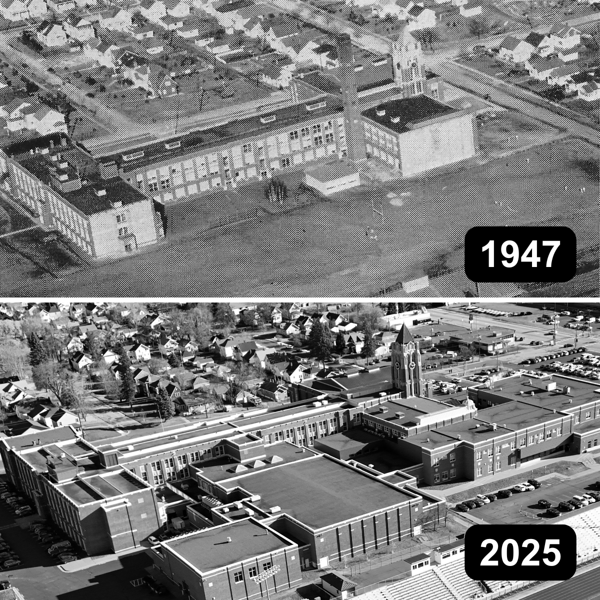
This aerial photo comparison shows Denfeld High School as it looked in 1947 and in 2025. The building first opened in 1926 — 100 years ago — and has seen several additions since then, including a gynasium wing in 1987 and a science wing and common area in 2011. The athletic stadium on campus saw a major renovation in 2002 when a new grandstand was built and the natural grass was replaced with artificial turf. (more…)
Then and Now: Cathedral and Marshall
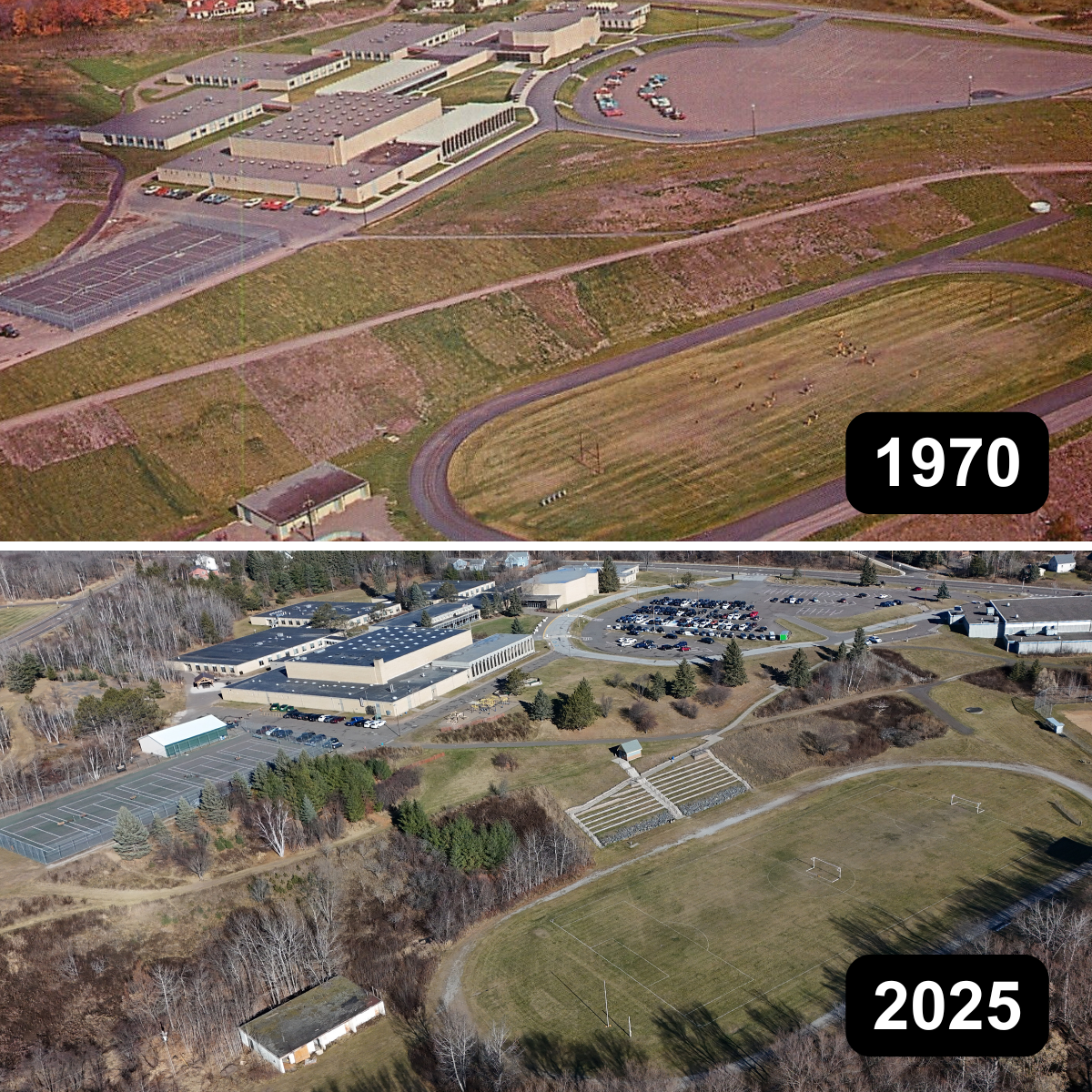
This aerial photo comparison shows Duluth Cathedral High School circa 1970 and the same campus in 2025 as Duluth Marshall School. (more…)
Then and Now: Nopeming Sanatorium
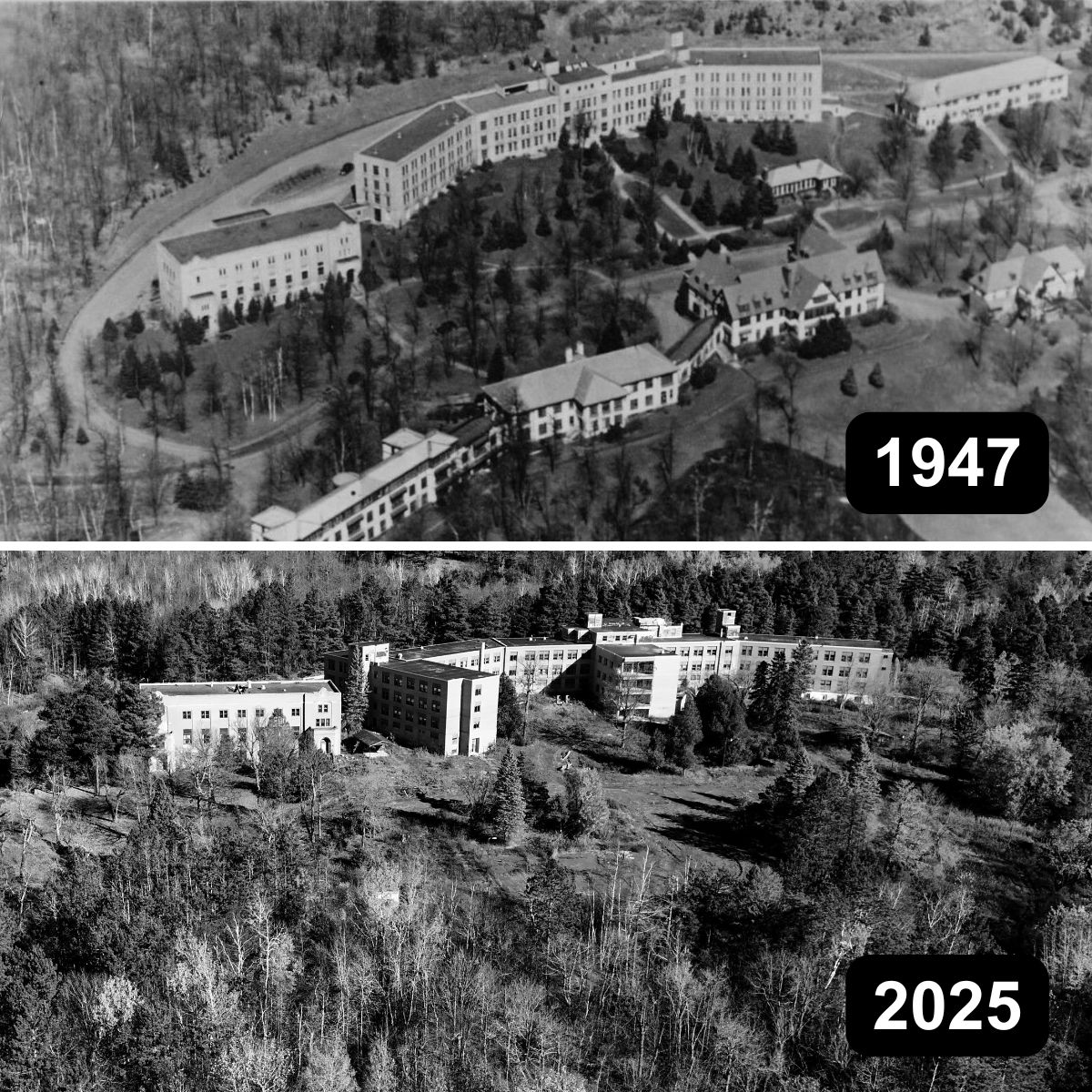
The above aerial photo comparison shows changes spanning roughly 80 years at the 40-acre site of the Nopeming Sanatorium in Midway Township, just outside Duluth. (more…)
Postcard from Lake View Tea and Dining Room

This undated postcard shows the Lake View Tea and Dining Room at 730 E. Superior St., “on the shore of Lake Superior where you can view the large steamers coming and going.” (more…)
Postcard from the Willard Motel

This undated postcard shows the Willard Munger Inn circa 1970, when it was simply the “Willard Motel.” It is still in operation in Duluth’s Norton Park neighborhood. (more…)
Fred W. Erickson, Duluth Grocer
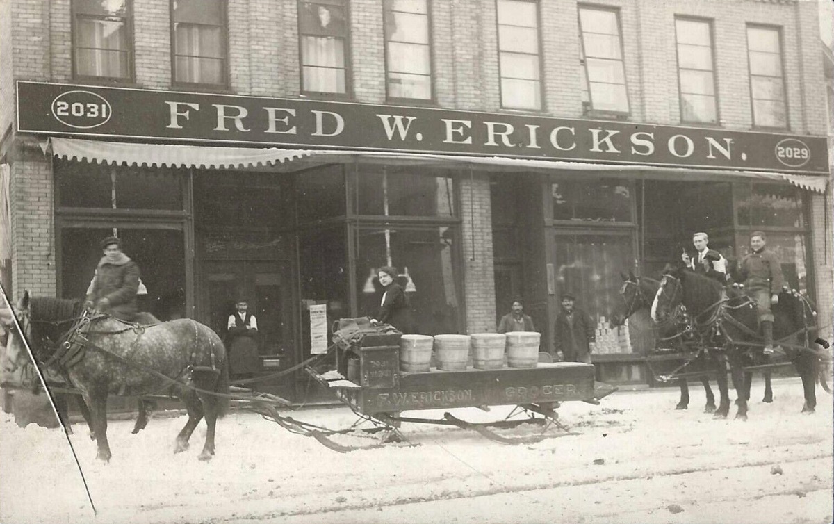
This postcard image shows the Fred W. Erickson grocery store at 2029 and 2031 W. Third St. in Duluth. (more…)
Superior Street 1963/2023 – Part Two: Change
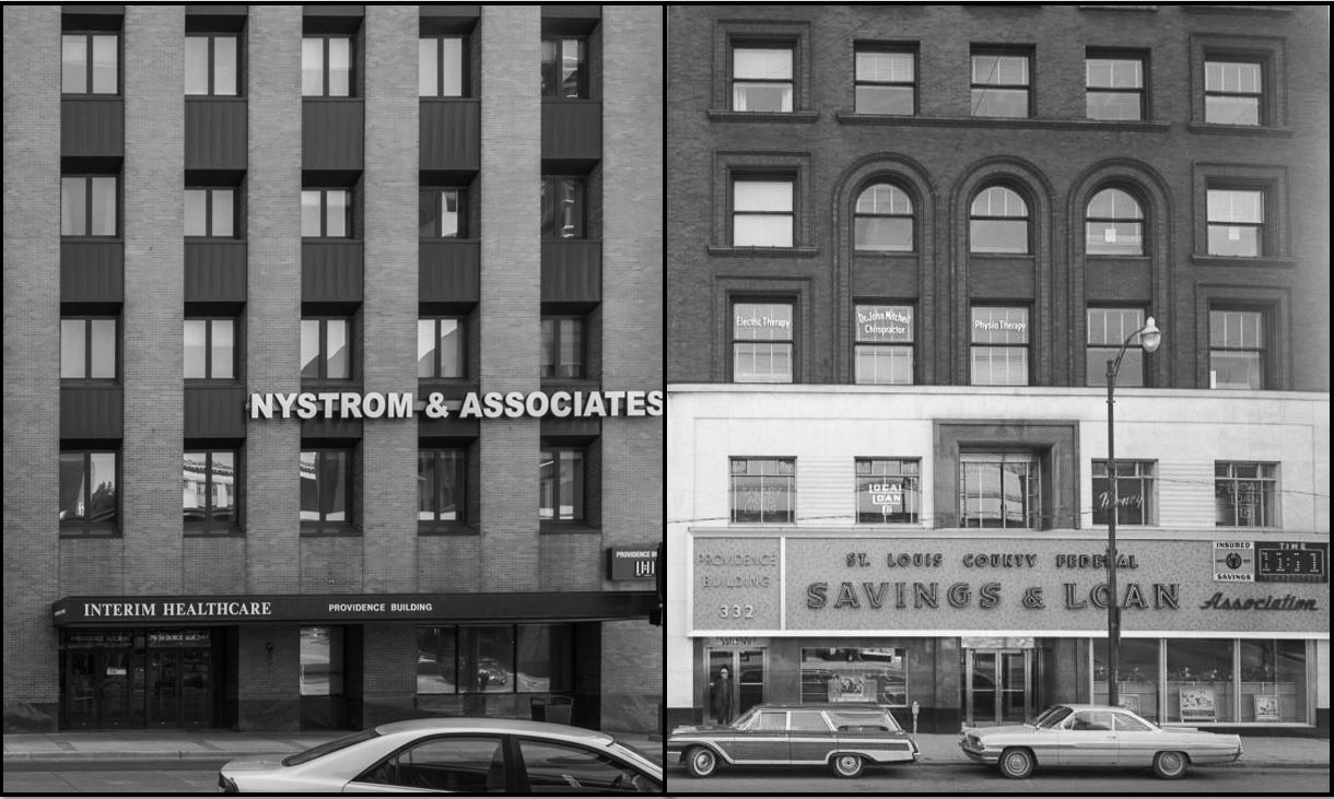
The Providence Building, 332 West Superior Street, 11:11 a.m.
The first post in this series looked at locations along Superior Street that have gone largely unchanged over the past 60 years. This set of 10 photos looks at locations where the difference between 1963 and 2023 are a bit more evident. In some cases, that is because of major developments like the Gateway Renewal Program, the Holiday Center, the Skywalk system or the I-35 extension. In other instances, it is simply because at some point the building acquired a new façade. (more…)
Superior Street 1963/2023 – Part One: Continuity
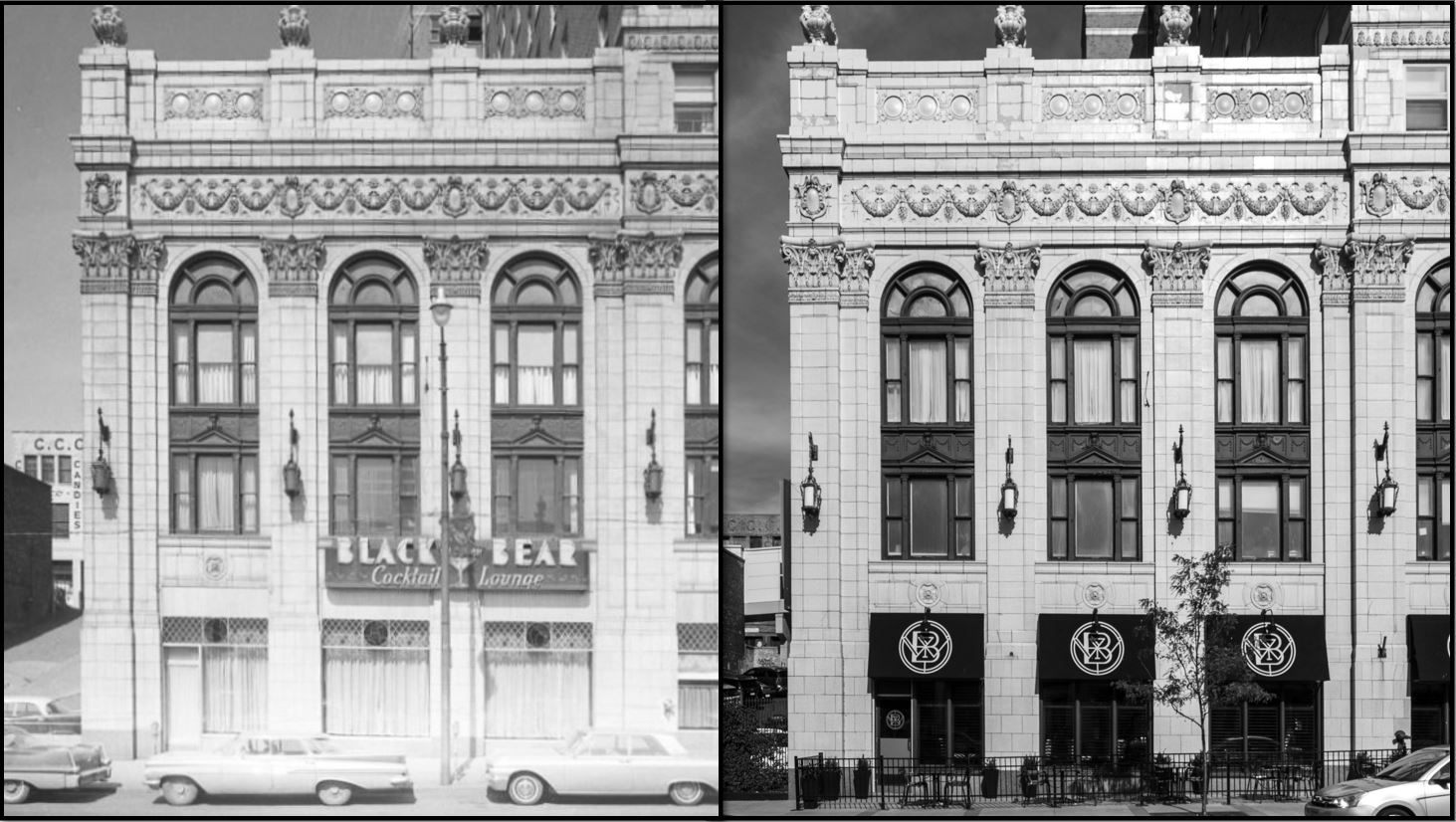
In 1963 an unknown photographer systematically photographed Superior Street, capturing downtown buildings and businesses on both sides. Ninety-five of these images have been preserved on the Minnesota Reflections website. (more…)
Wholesale Flour, Feed, Grain and Hay
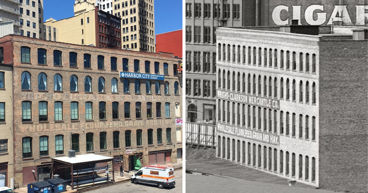
Recent work on the Duluth Plumbing Supply building at 322 W. Michigan St. — now SPS Companies — has made more visible the words painted on the back side more than a century ago. The bottom line reads “Wholesale Flour, Feed, Grain and Hay.” The top line originally read “Wright-Clarkson Mercantile Co.” but appears to have later been painted over with some other words.
The old-timey photo is via Shorpy and is dated “circa 1905.” St. Louis County property tax records list the building as constructed in 1910, but that’s potentially not accurate.
Duluth aerial photos, then and now, compared and combined
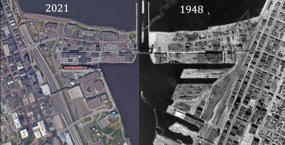
Sometime back, I included an aerial photo in a PDD comment and realized that because they are taken from straight overhead, the photos on Minnesota Historical Aerial Photographs Online can be matched up pretty easily with Google’s current aerial imagery. And then I put that thought aside for quite some months until I finally came back to it and put together this seven-part series of aerial photos showing places in Duluth that have changed somewhat dramatically over the past decades. (more…)
Last Chance Liquor and the Pawnbroker, 2011/2021
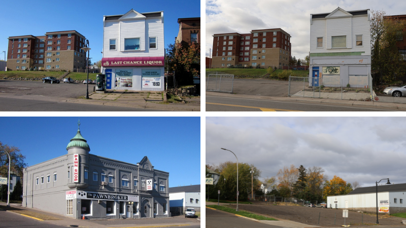
Here’s a look at a pair of East Fourth Street buildings — one soon to be demolished, another already lost to history. The photos on the left in the side-by-sides above are from Oct. 22, 2011. The ones on the right are from Oct. 22, 2021. (more…)
The Kozy 2010/2020

Top: Kozy Apartments on Nov. 17, 2010 — two days after a fire.
Bottom: Kozy Apartments on Nov. 17, 2020 — 16 days after a fire.
Then and Now: Looking Down 43rd Avenue West
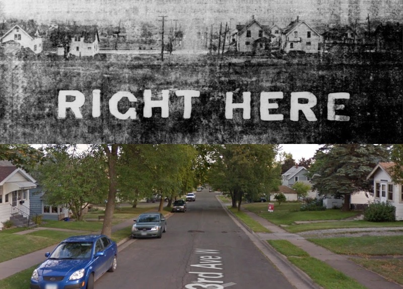
The top half of the graphic above is from a real estate advertisement in the Oct. 22, 1920 edition of the Duluth Herald, promoting lots on 43rd Avenue West near Eighth Street in West Duluth. The bottom half is an attempt to capture the modern perspective via Google Maps. In the modern view, trees block three of the four homes shown in the 1920 view, but one of them can been seen and the other three, though not in view, are still standing. (more…)
Rephotographing Duluth 2010/2020
In this video, photographer Kip Praslowicz revisits Duluth locations he shot photos of in 2010 in order to shoot 2020 versions.
One of the photos near the end of the video caught our eye at Perfect Duluth Day because Paul Lundgren shot a similar photo in 2010 from a different angle, showing a perspective that might have easily been forgotten. (more…)
Duluth’s Neighborhood Telephone Exchanges, 1920
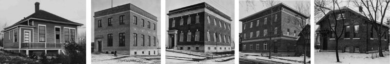
One hundred years is a long time, and the Duluth of one hundred years ago can seem like a place without much connection to the present. But whether we are aware of them or not, elements of the past always carry over into the present. As an illustration of that, these five images, taken by Duluth photographer Hugh McKenzie and included in UMD’s Kathryn A. Martin Library Archives and Special Collections, show the city’s neighborhood telephone exchanges in 1920. Shown individually below, they are followed by the most recent Google Streetview image of the same location. (more…)
Selective Focus: Duluth Then & Now
https://www.instagram.com/p/B2Cw8uAnENv/
Even if you’re not a history nerd, you’ve got to admire the effort put into finding and recreating these photos and the point of view. The images are from John McLoughlin’s @duluth_then_and_now account on Instagram. (more…)
Then and Now: Blue Crab Bar / OMC Smokehouse

The above photo was shot on Aug. 29, 2009 at the Blue Crab Bar, 1909 W. Superior St. Today it is the location of OMC Smokehouse. The photo below, shot Aug. 29, 2019, attempts to replicate the scene. (more…)
Mystery Photo #80: Rust-Parker and its neighbors
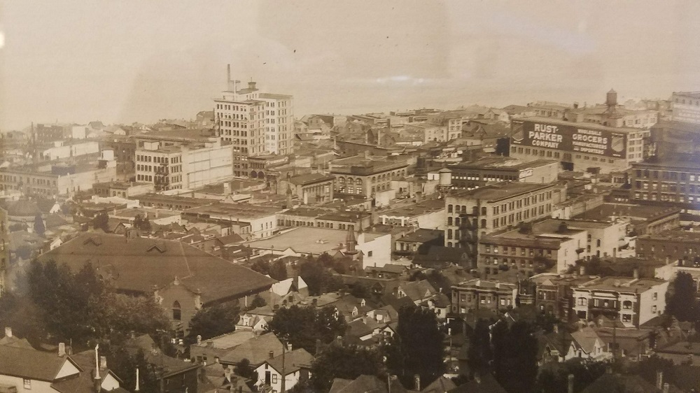
Lars Waldner posted this circa 1916 image to Facebook, tagging PDD. It’s kind of a bizarre angle on Duluth, and for some reason identifying buildings in the photo is exceptionally challenging. The only cheater we’re given is the big sign on the side of Rust-Parker Wholesale Grocery Company, which was at 217 S. Lake Ave. (more…)
Mystery Photo #76: 400 block of West Superior Street
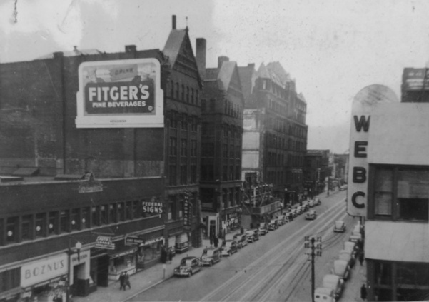
The above photo, submitted by Jay Sonnenburg, shows businesses on the 400 block of West Superior Street. At right is the WEBC Radio studio. At left are the Fargusson Building, Manhattan Building and Spalding Hotel. (more…)
Postcard from West Superior Street in 1908
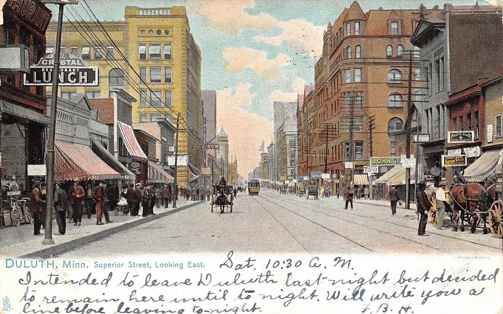
This postcard depicts a scene looking east from the 500 block of West Superior Street, where the Radisson Hotel and Duluth Public Library stand today. It was mailed 110 years ago — Aug. 29, 1908. (more…)
“The Glen” at Garfield Park in Duluth

This 1897 issue of Duluth’s Labor World shows the waterfall and cauldron of “the Glen” in Chester Park. From 1894 to 1902 the area was named Garfield Park. (more…)
Postcard from West Third Street in 1908
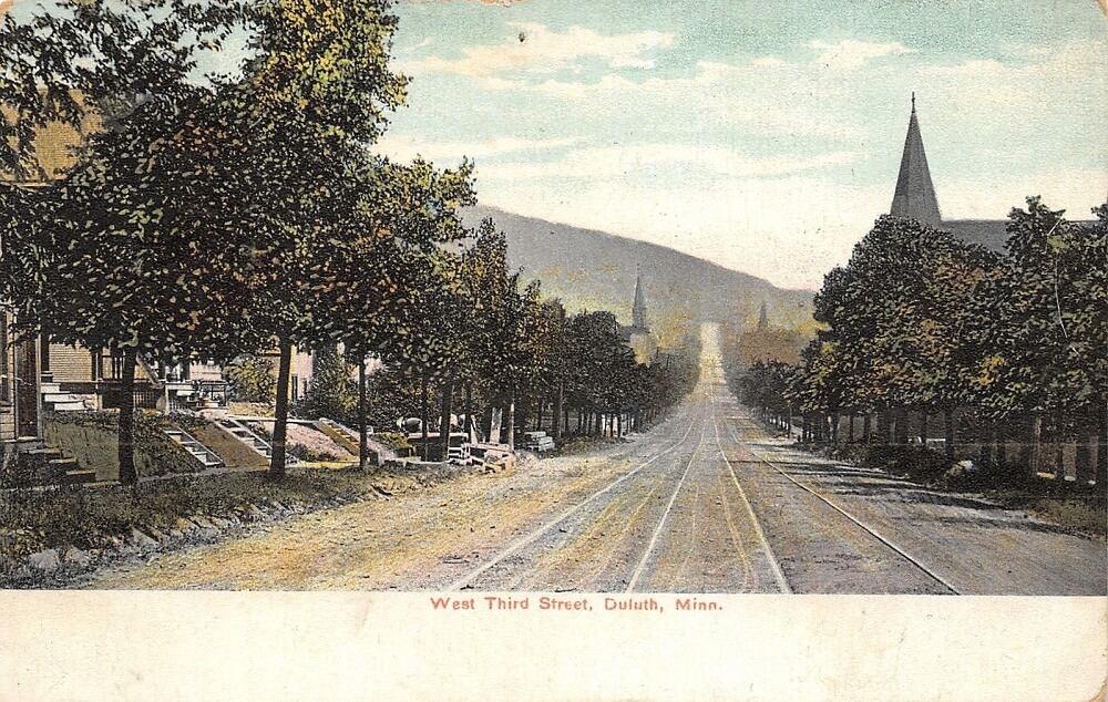
This postcard was mailed 110 years ago today — Aug. 14, 1908. It depicts a scene looking northeast on Third Street at about 24th Avenue West. The church steeple in the right foreground is Bethany Lutheran Church, built in 1903. (more…)
Northwestern Oil Company Filling Station
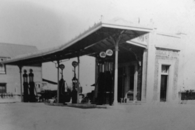
The Northwestern Oil Company filling station was built in 1921 at 716 E. Superior St. This photo from Jay Sonnenburg’s family collection is likely from the very early days of the gas station’s existence. The building is now home to the Portland Malt Shoppe. (more…)
Then and Now: Grand Avenue at Knowlton Creek
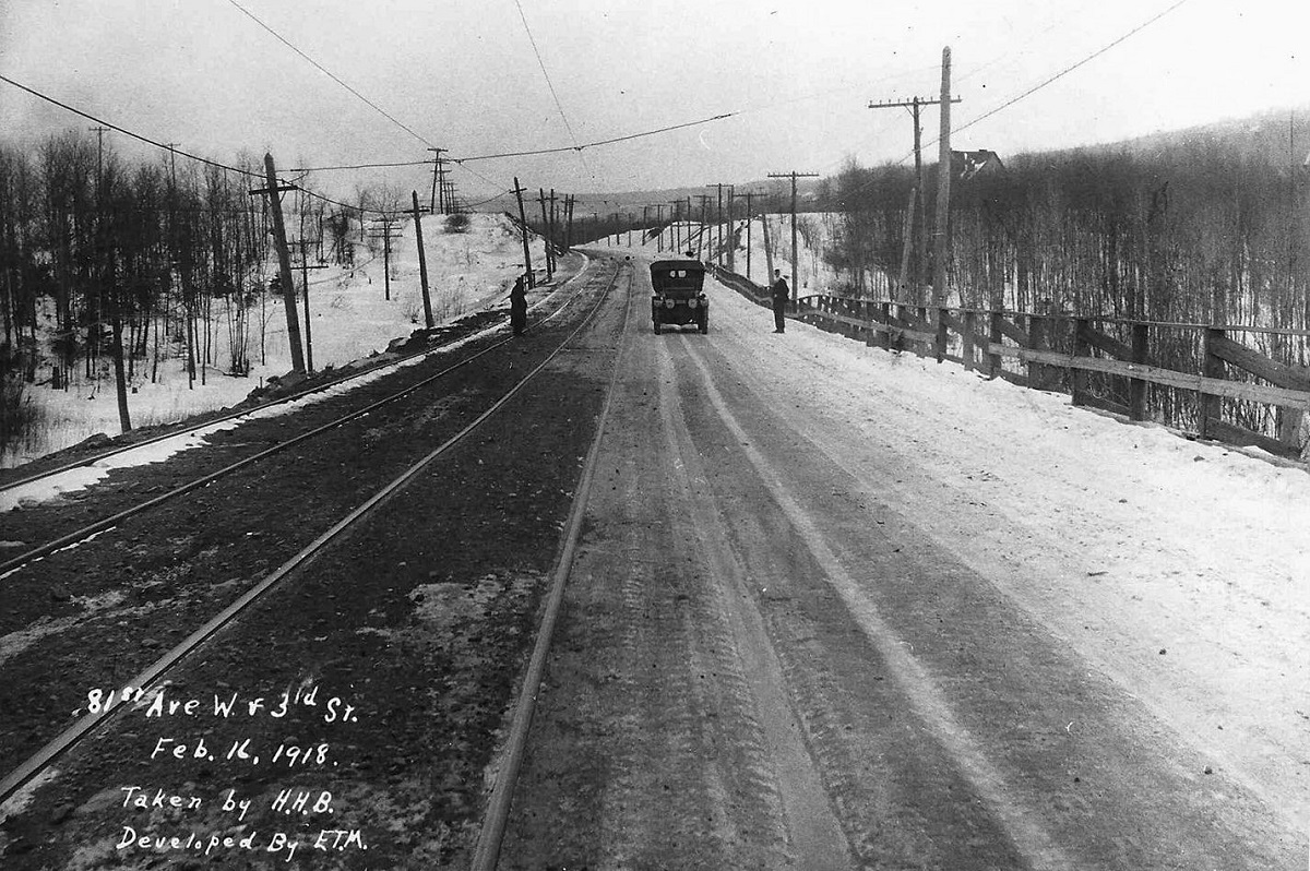
The image above shows Grand Avenue at Knowlton Creek, looking from Duluth’s Norton Park neighborhood toward the Riverside neighborhood. It’s dated Feb. 16, 1918. At the time, Grand Avenue was named Third Street. What does it look like today? (more…)