Postcard from a Rest Point Overlooking the St. Louis River
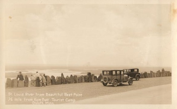
The text on the front of this undated postcard, found listed for sale on eBay, reads: “St. Louis River from Beautiful Rest Point 1/2 mile from Kum Bak Tourist Camp, Duluth, Minn.”
Anyone who has ever heard of Kum Bak Tourist camp, please enlighten in the comments.
Pretty sure it’s “Kum Bak,” as in “Come back.” Clever little touristy naming convention back then. Online searches don’t show much on this particular spot but the name was used elsewhere for restaurants, etc.
Thanks Gina. Yes, it’s Kum Bak, not “Kum Bok.” I have fixed it on the original post.
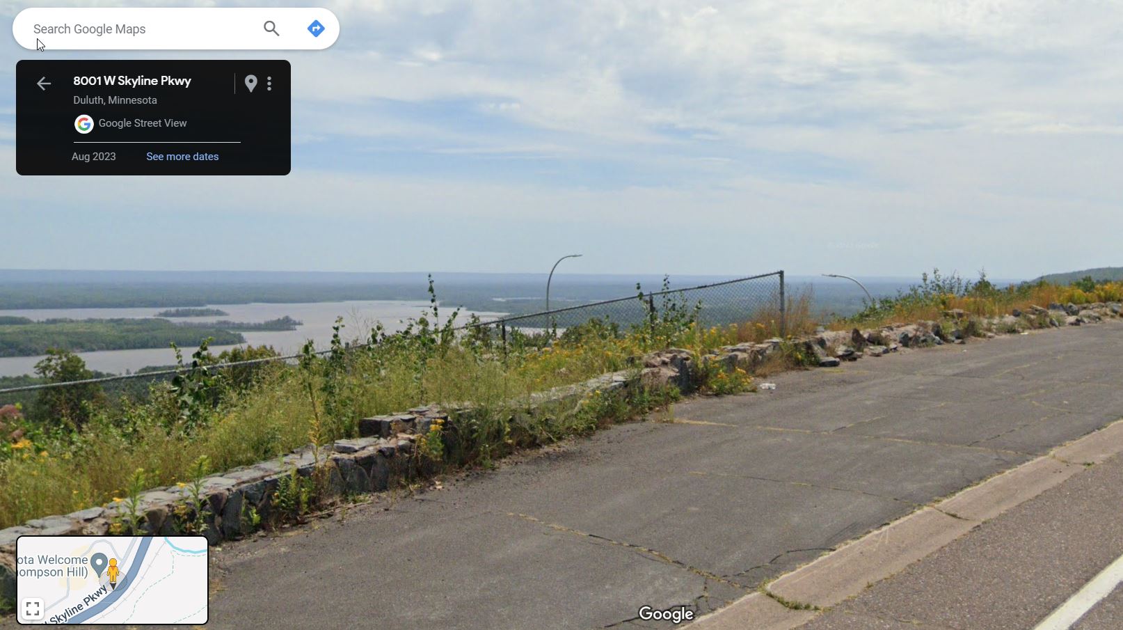
This seems to have been taken on Skyline Parkway below the current Thompson Hill rest area. Clough and Spirit Islands are on the lower left and Morgan Park is across Spirit Lake from there.
Looking in a half mile circle around I find a lot of areas that could have been a tourist camp but no real evidence of any.
Apparently the Kom-Bak is mentioned in a book called, “Minnesota Vacation Days”, by Kathryn Strand Koutsky and Linda Koutsky, published by Minnesota Historical Society Press. I don’t have the book, but found it on Walmart’s site, of all places. From the liner notes:
“From primitive camping facilities at Minnehaha Falls to mom-and-pop tourist courts like the Kum-Bak Camp in Duluth to spectacular grand lodges like Burntside in Ely, this lavishly illustrated history showcases the North Star State’s most memorable holiday haunts.”
This 1932 postcard both shows the camp and provides a description of the location.
The Highway 1 described on the postcard seems to refer to Minnesota Trunk Highway No. 1, which opened in 1924, and was the first portion of the Duluth-Twin Cities road to be paved on the northern side. It connected West Duluth to Esko’s Corner in Carlton County. As a News Tribune story states, quoting a Duluth Herald story from July 16, 2924, “Highway 1 extended from 59th Avenue West along a ‘new low-grade climb over Thomson Hill, doing away with the steep hill formerly in use. From Esko’s Corner, contractors are now laying the pavement to Carlton.'”
The Tribune story also notes that “A chunk of old Highway 1 still snakes up into the woods above Kingsbury Creek, however. It’s blocked off to motorists by large boulders.”
As Waferdog notes, that would seem to put the camp somewhere near the present Thompson Hill Scenic Overlook.
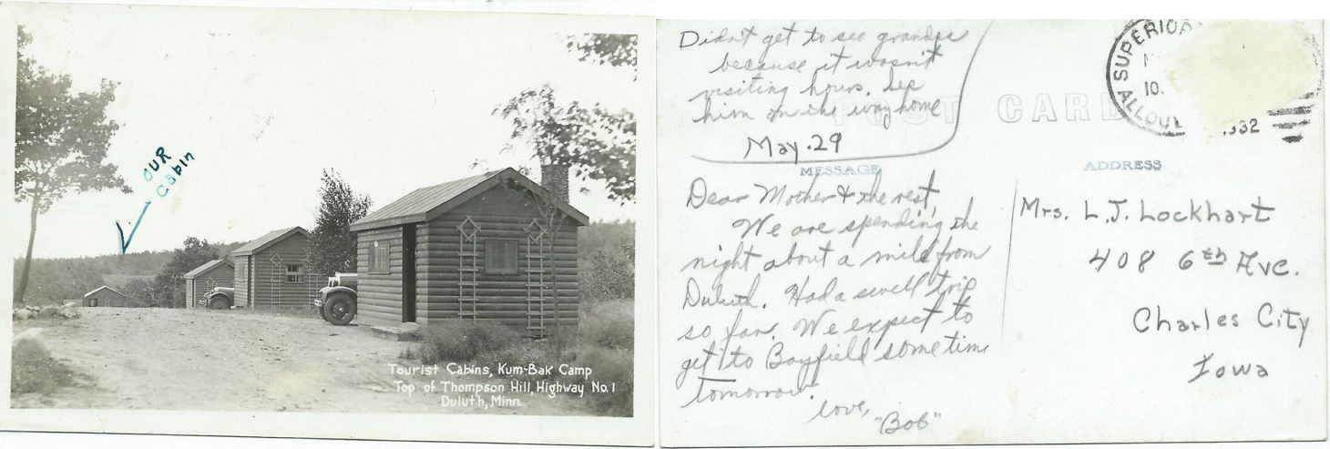
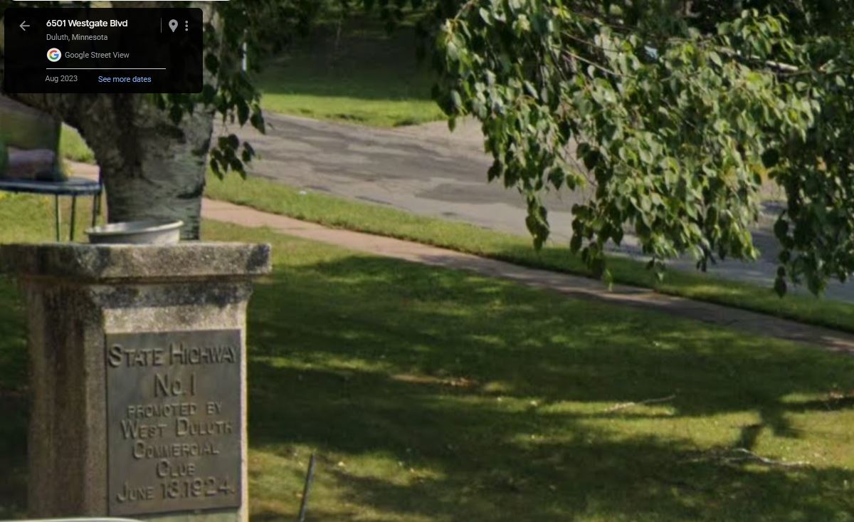
As described in the Duluth News Tribune story linked to above, there is still a State Highway 1 commemorative marker from 1924 in what is now the front lawn of a home built 40 years later on Westgate Boulevard and 65th Avenue West.
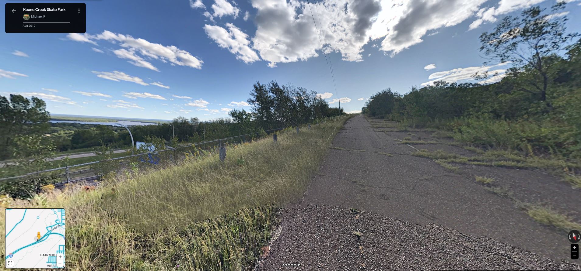
Also as noted in the News Tribune story, the road is no longer open to car traffic but a stretch of it still exists above I-35 for anyone who wants to take a walk in search of remnants of the Kum Bak Tourist Camp.
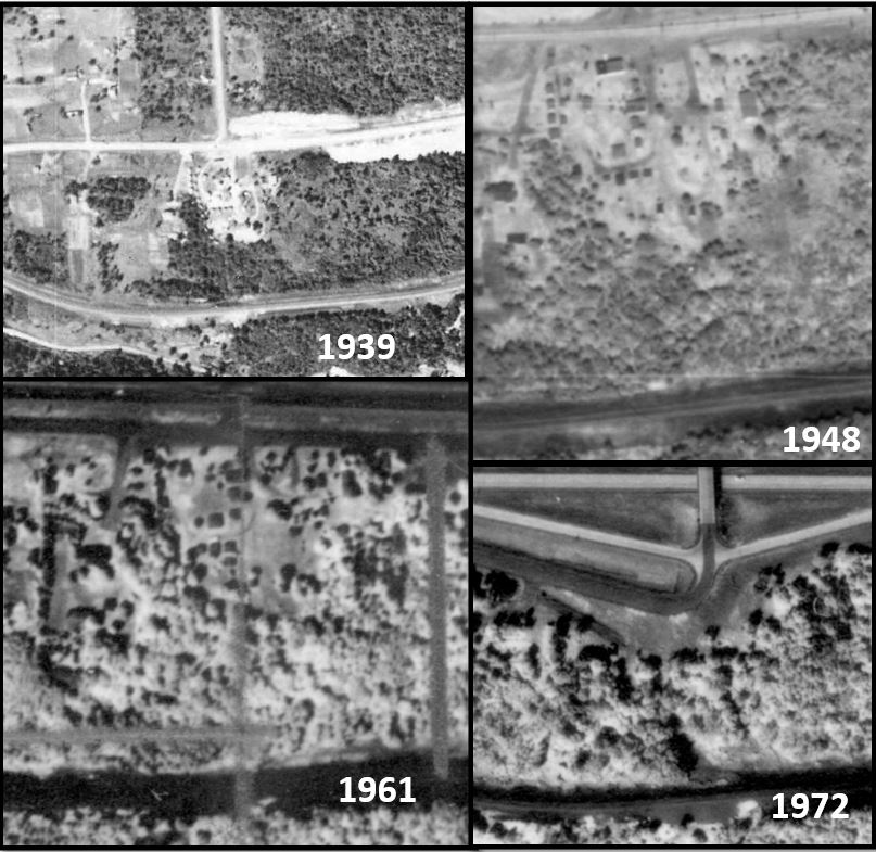
A walk on the old highway might not be necessary. Looking at the earliest available images from Minnesota Historical Aerial Photographs Online, a 1939 photo shows what seems to be a series of very small buildings on the top of Thompson Hill just off of Highway 1, where Boundary Avenue now intersects with I-35. They have the same spacing and alignment as in the Kum Bak Camp postcard. Small buildings in different configurations can also be seen at that location in 1948 and 1961 aerial photos, but disappear in the next available photo in 1972 with the construction of 1-35.
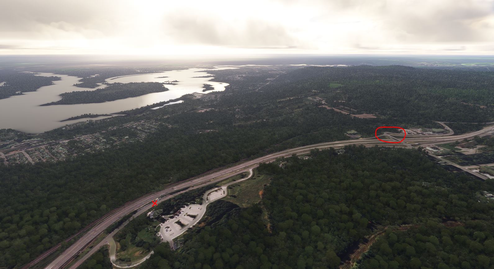
As marked by the circle and x in the image below, the camp location above and the rest point location identified by Waferdog are a little more than a half mile from each other on Thompson Hill, matching the information on the postcards.
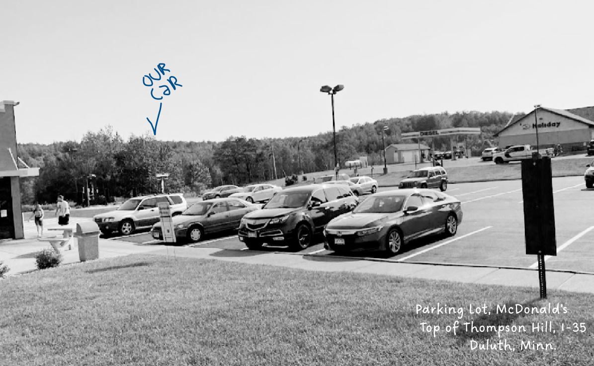
So, basically what we’ve learned here is that the McDonald’s on West Skyline Parkway in Proctor used to look like this.
I guess so. And in that spirit I’ll add in this photo. Maybe it will end up somewhere 100 years from now and someone will enjoy trying to make some sense of it.