West Duluth before the Interstate
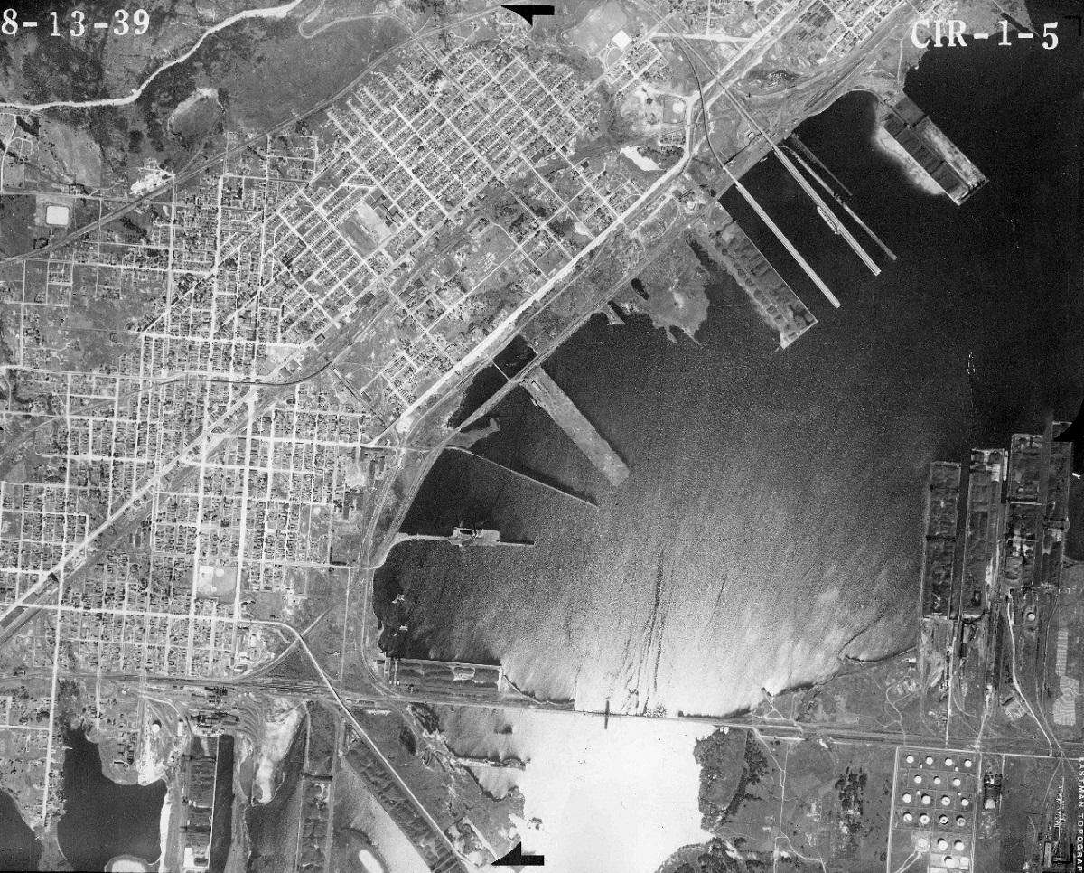
1939 aerial photo from the UM
MnDOT’s John Bray wrote in The Will and the Way: “Approximately 700 homes were razed or moved in West Duluth” to make way for Interstate 35.
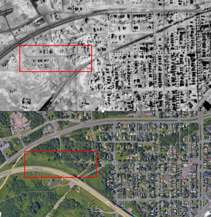
The Superior Hiking Trail goes through this area — east from the zoo to 63rd/Green Street and then up the hill across Cody Street.
There is but one house left on that part of Green Street, 6415, but an entire neighborhood existed there. The SHT, in fact, goes through where a house sat at 6416 Green St. — and there are still irises and lilacs growing today. Were you a part of this neighborhood? Can you message me, please?
To try to get a better sense of things I’ve taken a section of the 1939 aerial photo and drawn in with a dotted red line the rough path I-35 takes today (above). And I did the same with a 1961 aerial photo (below).
There are a lot of aerial photos available online from different years. One could lose hours zooming in on specific areas and comparing. See Minnesota Historical Aerial Photographs Online.
It seems the 1961 map was recently used in an inventory of homes demolished for I-35 that was conducted by Duluth Waterfront Collective.
That process was able to confirm 529 homes lost overall in Duluth and 314 in West Duluth. (Technically, it counts 212 in West Duluth and 102 in Oneota, but Oneota is a sub-neighborhood of West Duluth, so why it got broken out and other sub-neighborhoods did not is confusing).
In the methodology section it does mention:
It’s easy to think that this was in the past, and we’re smarter now, but the tradition of destroying productive places for car infrastructure continues. Whether it’s demolishing a home for an arbitrary turn lane on Woodland Avenue or destroying 5+ units of housing for roundabouts in Lakeside, we haven’t learned.
In terms of time lost looking at the details of that 1961 aerial photo, here are the results of my one hour zooming in on Green Street, mentioned in original post and boxed in red in the attached comparison. I think it’s interesting how regional transportation has always shaped that neighborhood, with the railroad going out just as the Interstate came in. East of Green Street the trees growing on empty lots clearly show the old path of the tracks. Maybe 60 years from now someone will be creating a post showing how you can still see the path of the old Interstate. Although If aluminumpork is correct, that path may be below the newer, wider Interstate.
Matthew James – this is really very helpful! thanks for doing this!