
Duluth Harbor Basin, 1925
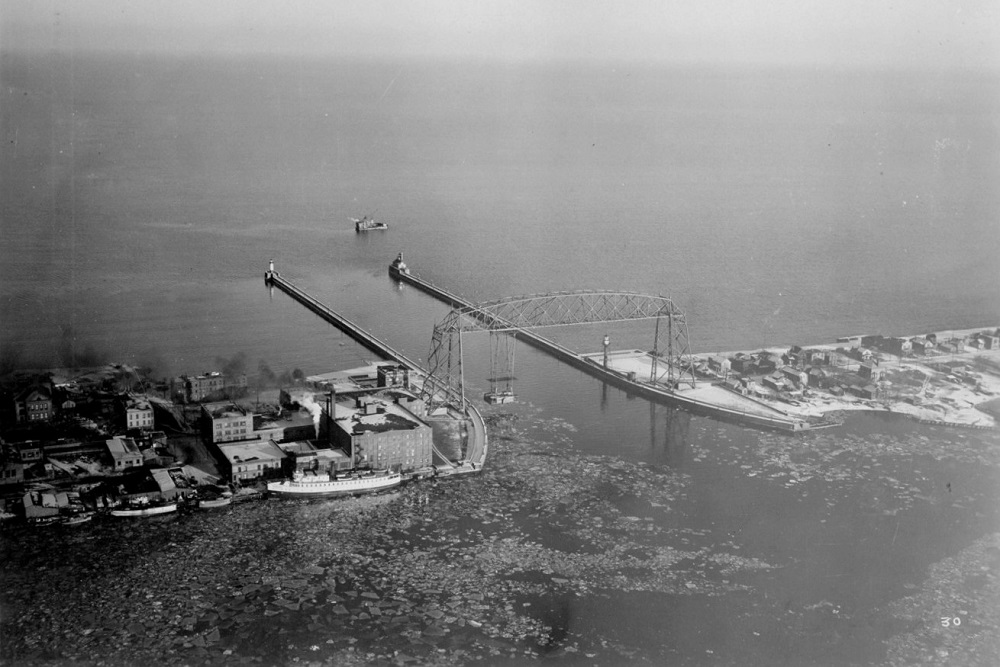
This photo from the National Archive was taken on an airplane from the McCook Field aviation experimentation station in Dayton, Ohio, which was flying in the region for a photographic mapping expedition of the Canadian border in October and November of 1925.
The caption on the photo reads:
Duluth Harbor Basin, the main business section and portions of Lake Superior, showing the “Eighth Wonder of the World,” the Aerial Bridge connecting Duluth proper with a long neck of land known as Minnesota Point, which really makes the Duluth Superior Harbor.
Historic, as MPLS Star Tribune reported:
Looks like the America at the dock.
That does indeed appear to be the SS America, three years before her demise.
Here are two alternate shots. The ice in the top one makes it likely it was shot on the same day, perhaps mere moments before the shot featured in this post. The one below is missing the ice chunks, which makes me think it was shot earlier in the season.
Here’s a first-person account of riding the America, likely from that Berth. It stunk of fish, apparently.