PDD Drone
Wisconsin Point Breakwater and Lighthouse
The PDD Drone takes a short flight along the west pierhead entrance to Superior Harbor at Wisconsin Point, cruising above the breakwall to the Wisconsin Point Lighthouse, also known as the Superior Entry Breakwater Lighthouse or South Breakwater Light.
Northern Pacific Ore Dock in Allouez
At Loon’s Foot Landing in Superior’s Allouez neighborhood, near the mouth of the Nemadji River in the Allouez Bay Channel, stands the remains of the Northern Pacific Ore Dock — built from 1912-13; abandoned by 1970. In July, Liftoff Aerials sent the PDD Drone up to have a bird’s-eye view of the old concrete-and-steel structure. (more…)
Manitou River Falls Minnesota North Shore
Here are some shots from the seldom seen Manitou River falls on Lake Superior near Highway 61. There are two main sets of falls between Highway 61 and the lake, the last set drops 40 to 50 feet directly into Lake Superior, making it one of only a few waterfalls that drop directly into Lake Superior. (more…)
Ely’s Peak Drone Tour
You may have noticed the PDD Drone has come out of hibernation recently. Here is a quick video of Ely’s Peak on the western edge of town. Yes, we did fly the drone through the entire tunnel. It was a bit hairy due to the darkness and the boulders that kept jumping out at our feet. The drone was wearing a small headlamp but it didn’t help much. (more…)
Devil’s Kettle Falls Drone Flyover
Quick drone flyover at Devil’s Kettle Falls on the Brule River in Judge C. R. Magney State Park on the North Shore of Lake Superior. This specific set of falls, about 20 minutes east of Grand Marais, draws visitors far and wide for it’s unique mystery: half the river disappears into a hole (kettle) and no one knows where all that water goes. (more…)
Five Mile Rock Drone Flyover
Five Mile Rock is located five miles north of Grand Marais (hence the name) and 3/4 miles off the shore of Lake Superior. Aerial video and photo shot with the PDD Drone on May 19 around 11:30 a.m. and operated by Liftoff Aerials, an FAA-registered drone operator approved for commercial use.
North Shore Fall Colors Fly Over
See the stunning autumn leaf colors on Partridge Ridge in this short aerial fly over. Location of aerial drone fly-over was here: https://goo.gl/maps/
Sunflower Drone Flyover
Shot somewhere on a road less traveled in West Central Minnesota.
Poplar River Falls Aerial View – Lutsen Ski Area
Poplar River falls is just north of Lutsen Ski Area and the Superior Hiking trail crosses the river at the apex of the falls.
Baptism River “High Falls” Aerial View -Tettegouche State Park
Aerial drone video of “High Falls” on the Baptism River. The Baptism River “High Falls” in Minnesota’s Highest waterfall at 60 feet. During spring run-off it flows heavily and is a great time to visit and hear the thunderous roar of the falls. Mid-summer you can swim the pool at the base of these falls. Tettegouche State Park is one of the best campgrounds on the North Shore of Lake Superior. https://dnr.state.mn.us/state_parks/tettegouche/
John Beargrease Sled Dog Marathon 2015 Video
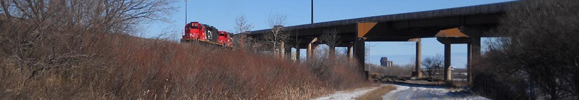
The PDD drone, piloted by Cory Fechner (liftoffaerials.com) was at the start of the 2015 John Beargrease Sled Dog marathon yesterday to shoot aerial footage. There were other drones at the starting line so we ventured out into the woods to capture the mushers a quarter-mile into the race.
Music: “Guit. Ditty” by Hattie Peterson from Twenty3 Years Into 4teen Songs.
FAA could release commercial drone regulations by end of 2014
 The expected release of new unmanned aerial vehicle (UAV) regulations later this month and the recent commercial drone incident with TGI Friday’s in New York (TGI Friday’s Dumb Mistletoe Drone Cut Somebody’s Face Open) have me thinking about the future of commercial drone use. Perfect Duluth Day has been somewhat on the forefront of the use of drones since I purchased a quadcopter capable of shooting photography and video back in 2013.
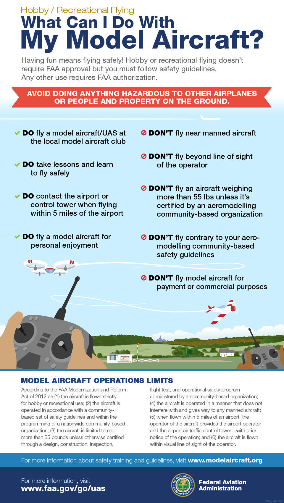
Current FAA Drone Guidelines
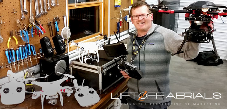
I utilize my 4 drones (DJI s800evo, Tarot FY680 Pro, DJI Phantom 2 Vision & Vision 2+) to shoot content for digital media, which has drawn attention beyond PDD via the Star Tribune, Pioneer Press, MPR and also Duluth news outlets. I was contacted by the Federal Aviation Administration in early 2014 after shooting the John Beargrease Sled Dog Marathon and told I was in violation of FAA regulations because my footage was considered commercial.
I won’t get into the specifics of what the current regulations entail, but needless to say they are bit vague and need clarification. The National Transportation Safety Board felt the same way, dismissing multiple instances in which the FAA fined UAV operators $10,000 for commercial operation. There has been kind of a wild west approach to commercial use of UAVs since then, with little risk of citations or fines until the new regulations are released. (more…)
Aerial Tour of Fall on the North Shore of Lake Superior
Aerial Footage by Liftoff Aerials. Music by Sarah Krueger.
Aerial fly over of Thomson Dam near Jay Cooke State Park
Drone fly over of the Thomson Dam and Munger Trail foot bridge on the St. Louis River near the entrance of Jay Cooke State Park. This is also home to the UMD Outdoor Program Outpost on the St. Louis River/Thomson Reservoir.
Aerial Footage by www.liftoffaerials.com
See more Duluth Drone Videos – Click Here
Glensheen Mansion Aerial Flyover 2014
This drone flyover of Glensheen Mansion was shot June 3. The footage is by Liftoff Aerials.
PDD Drone flight over the High Falls on the Pigeon River
Quick video at the High Falls on the Pigeon River last week. This waterfall is the highest in Minnesota at 120 feet. It was a very windy day but my new rotopixel two-axis gimbal performed well to keep the camera pretty steady. You can visit the falls at the Grand Portage State Park just a few blocks from the Canadian border on Highway 61. Aerial Footage by www.liftoffaerials.com
Music: “Especially Me” by Low
chairkickers.com
Gooseberry Falls State Park Drone Flyover
A little drone flyover at Gooseberry Falls State Park accompanied by Southwire music. Aerial Footage by www.liftoffaerials.com
Duluth Denfeld Sing-along Drone Video
Footage by Liftoff Aerials.
The Halls of Denfeld (alma mater)
Oh, we love the halls of Denfeld
That surround us here today.
And we will not forget,
Though we be near or far away. (more…)
PDD Drone over the ice … and on the news
The PDD Drone’s latest mission took it to the skies of Grand Marais last week, hovering across the icy shore of Lake Superior. Before the trip, however, the drone and its “pilot,” Cory Fechner, spent some time with the Northland’s NewsCenter’s Kevin Jacobsen for the report below.
Apologies for the commercial before the clip, which we can’t control.
2014 John Beargrease Aerial Drone Video
The PDD Drone was back in the skies yesterday capturing the start of the 30th annual John Beargrease Sled Dog Marathon. The weather was great and the winds held off just long enough to get in some air time above the race starting line at Duluth East High School.
Music courtesy of the4onthefloor (www.4otf.com)
Split Rock Lighthouse – Aerial Flyover
This is the first PDD Drone video, shot at Split Rock Lighthouse on Christmas Day. It was only the fourth flight in the drone’s young career, and we are still in the practice mode of getting smooth flyovers and panning when shooting video. We are improving with each flight and I personally think it is a huge accomplishment that the PDD Drone is not sitting at the bottom of Lake Superior … yet. So enjoy this unique perspective of Split Rock Lighthouse and let us know what you think.
The PDD Drone is a DJI Phantom 2 Vision.
