Duluth and the Harbor from Highway 11 in 1923
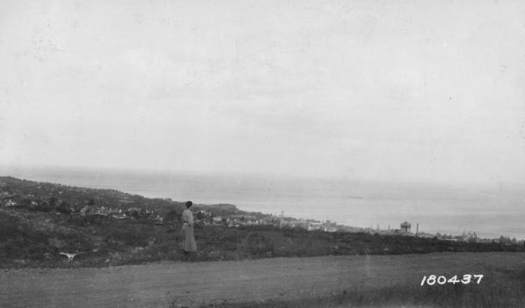
Photo by William L. Barker, Jr. for the U.S. Forest Service.
This photograph from the National Archive is dated Oct. 1, 1923 — 100 years ago today. The caption reads: “Duluth and the harbor on Lake Superior from Highway #11.”
I had no idea the Radisson was so old.
I love how the the old-timers hated trees.
The Radisson crack does raise the question of what that tallest building in the photo might be. The image quality isn’t very good, so it’s hard to pick things out as a reference.
According to Wikipedia: “State Highway 11 was authorized in 1920 from Donaldson east to International Falls, then south through the Iron Range to Duluth. U.S. 169 was routed along this highway from 1930 to 1934. In 1934, the north–south portion was redesignated U.S. 53.”
So if we imagine ourselves looking out from Highway 53 / Central Entrance as the woman in the photo is looking out from Highway 11, I think we are seeing an area more east of where the Radisson was built.
When we see a Duluth structure towering over the others in 1923, it’s tempting to think it’s the Alworth Building, but I think we are looking more easterly than that even. And maybe this building isn’t really very tall, but is surrounded by single-story structures.
Strib, June 1923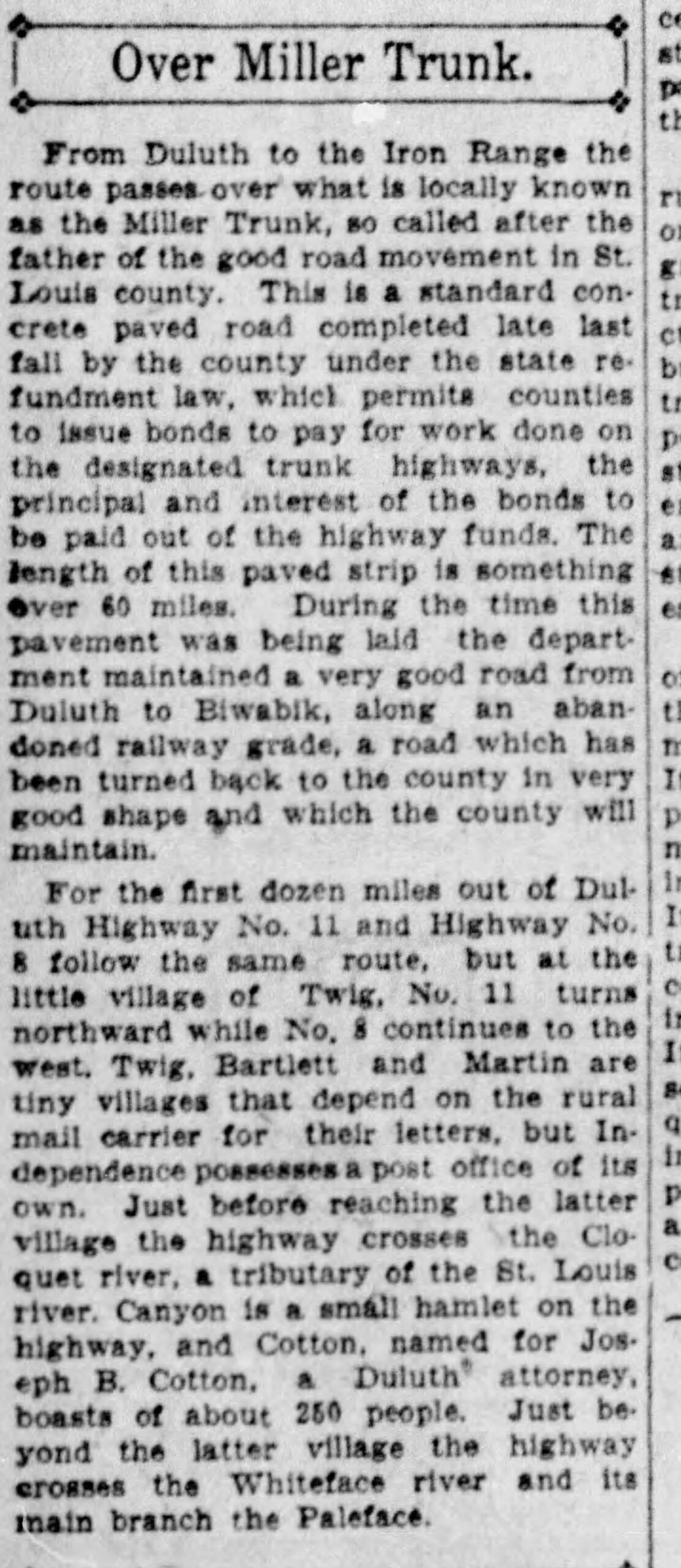
Probably St Mary’s Hospital … Center Building (west behind the main elevator core) is at least that old.
Two observations/questions:
Could the lack of trees in the foreground be a result of fires of 1918? I seem to recall references to the fires reaching the hills above Duluth.
Any idea of the source of the photo? The 6 digit serial in the bottom right is similar to historic USFS photo serials. FYI-They have a great collection online hosted at forest history society website; hard copies for both the superior and Chippewa national forest are at Ironrange discovery center in Chisholm.
Thanks Lager Man! The image does indeed turn up on the Forest History Society website, but unfortunately not at a higher quality than the version here. The site helps us identify the photographer, though: William L. Barker, Jr.
If we look from approximately the same perspective today using Google Earth, St. Mary’s seems to be in about the right location. But there used to be a large building between where the woman is standing and St. Mary’s. And if we go all the way back to Mystery Photo #72 from 1926, you can see the top of that building and neighboring chimney a bit more clearly.
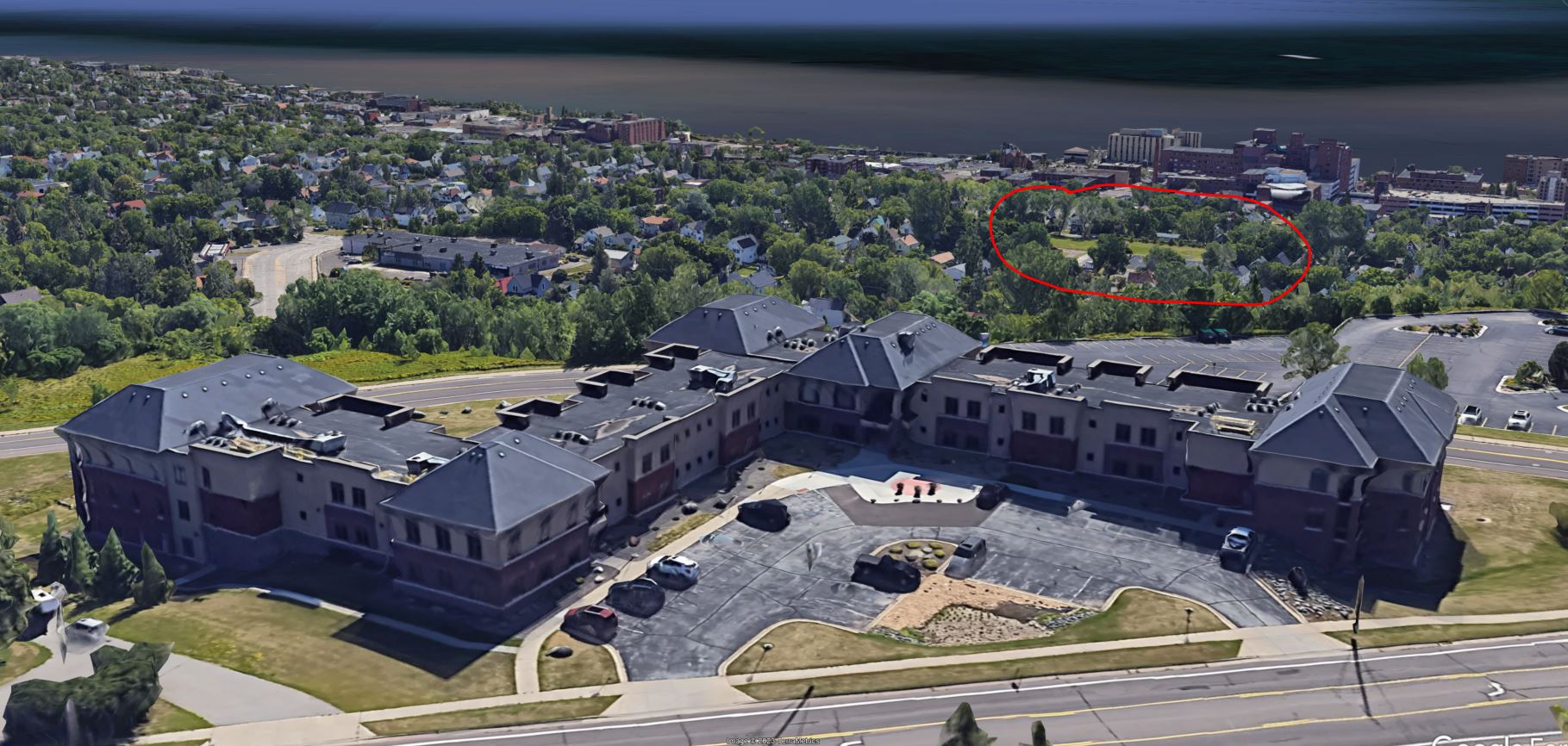
I think that blurry structure is the top of Franklin School.