

Maps
Duluth area map challenges on Geoguessr
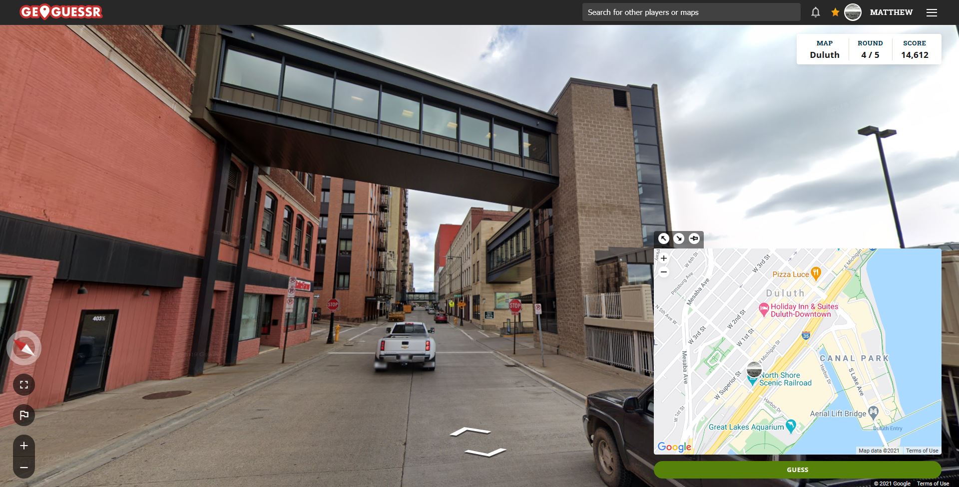
Geoguessr is a website that features variations on a rather simple game: you are shown a location through a modified version of Google Streetview. You must guess where you are by marking the location on a map. The labels and location marker normally added by Google have been removed, so you must rely on a compass and clues from the environment. The closer your guess is to the correct location, the more points you get. Each game consists of five rounds. The tops scores appear on the main page for each map, with a tie going to the player who finishes the fastest. (more…)

Land of the Sky Blue Waters

This illustrated map depicting “The Minnesota Arrowhead Country” is from the Hotel Duluth Coffee Cub menu, circa the mid-20th Century. The illustration is by wildlife painter Louis S. Raymer, who graduated from Duluth Central High School.
The Minneapolis Star Tribune published an article about Raymer’s career in 2014: “Painter Louis Raymer, 85, on life, career and the heyday of wildlife art.” Raymer died in 2016.
Lake Superior Aquaman’s Duluth
[arve url=”https://www.google.com/maps/d/embed?mid=13xUzaotRXCX4Q5tX_01IiJbDvUmJEYW5&hl=en”]
Explore this interactive map for the bounty of our Northlandic Atlantis. Containing hundreds of photos, video and links, this is a virtual tour of the area with a focus on water, wildlife, history, and recreation.
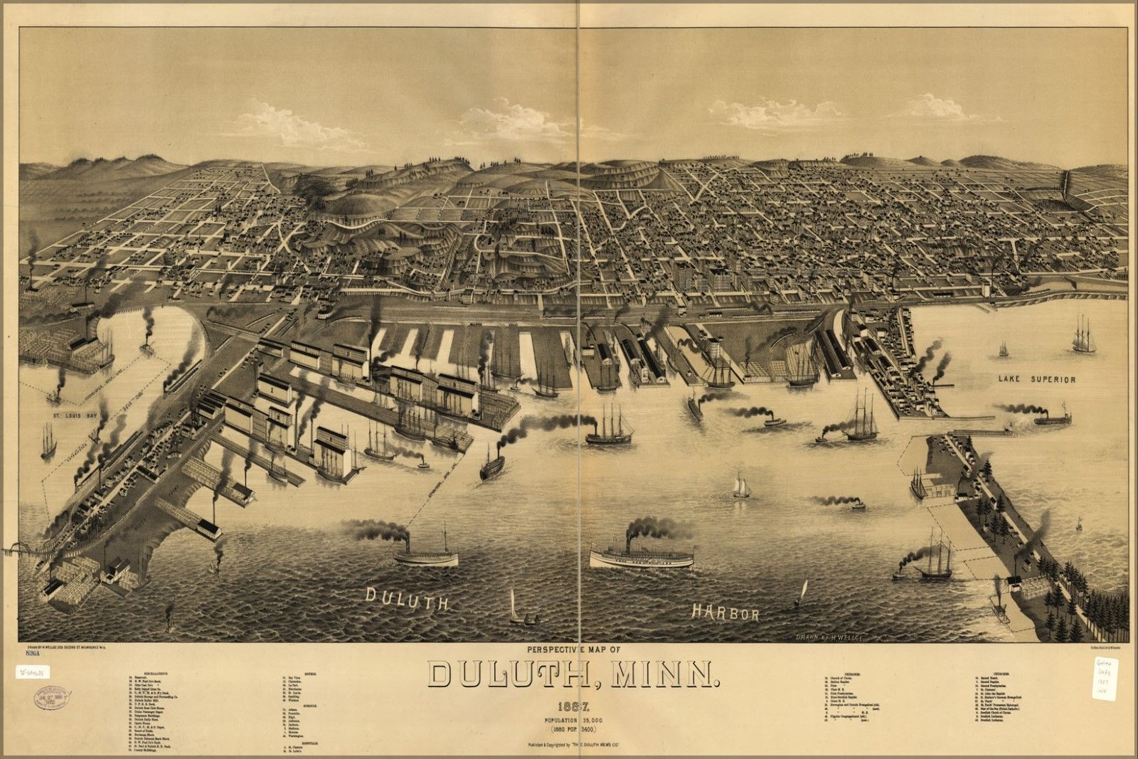
Perspective Map of Duluth in 1893

Similar to the “Perspective Map of Duluth in 1887,” but more recent and from a bit different angle.
Official Map of the City of Duluth, 1889
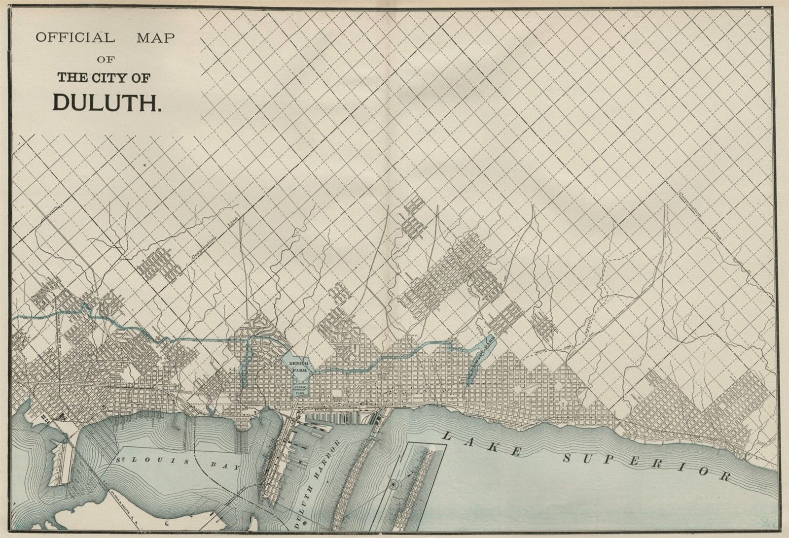
From the days when Enger Park was Zenith Park, and Chester Park was Glenwood Park (or is it Lenwood?). (more…)
Map of the Day: Duluth’s Canal Parking
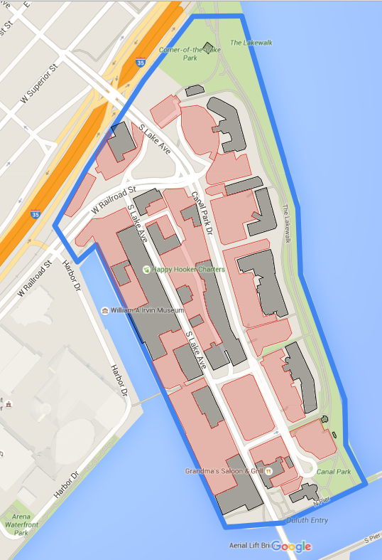
After a ridiculously warm weekend, it seems like spring has arrived early. Before you know it, thousands of Minneapolis-types like myself will be driving up Interstate 35 to the cool shores of Gitche Gumee.
Since its post-industrial low point a few decades ago, Duluth has built Canal Park into one of the top-drawing tourist spots in the state. It’s definitely a great place, but I continue to be amazed by how much prime Canal Park real estate is occupied by pavement for storing cars. After a visit last fall, I made this map and found there are 21 acres of surface parking in Canal Park. (more…)
Official Map of the City of Duluth, 1887

From George F. Cram’s Atlas, published in 1887.
Dialect Map
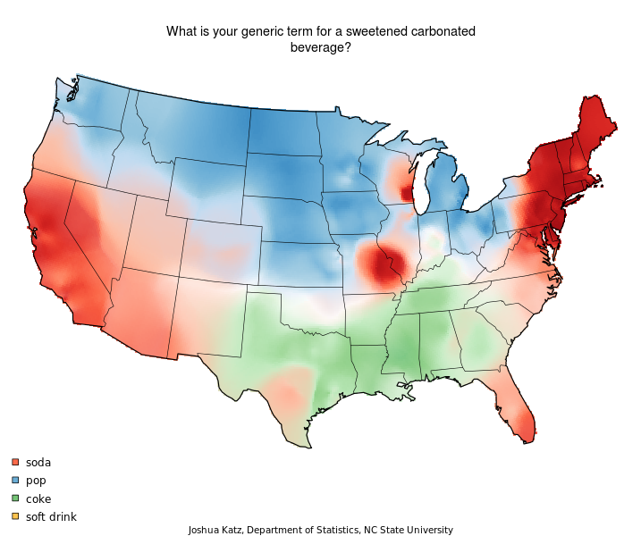
Fascinating way to understand Duluth linguistically. Hat tip to @Kate Vo Thi-Beard. Salute to Mike Linn and Chongwon Park.
Wikimapia
It’s kind of a weird name, it’s something that I discovered while doing “armchair” history research, and it’s become a hobby of sorts. Wikimapia is sort of like Wikipedia + Google maps, or as they put it; “a multilingual open-content collaborative map, where anyone can create place tags and share their knowledge.”
So basically if you sign up, (which it’s free), you can draw polygons around locations like a building, park, or historical places and then add the information about it, add photos, tags and what have you. Once it’s saved, others can view it, comment on it, or even update it as well if they have something new to add. You can add lots of other information too, like roads or railroads.
I know that there are some people here who dig history and know a lot of facts about our area, so I just thought it’d be cool to share and hope that maybe they will share their knowledge on the site as well, or at the very least, simply just looking around it.