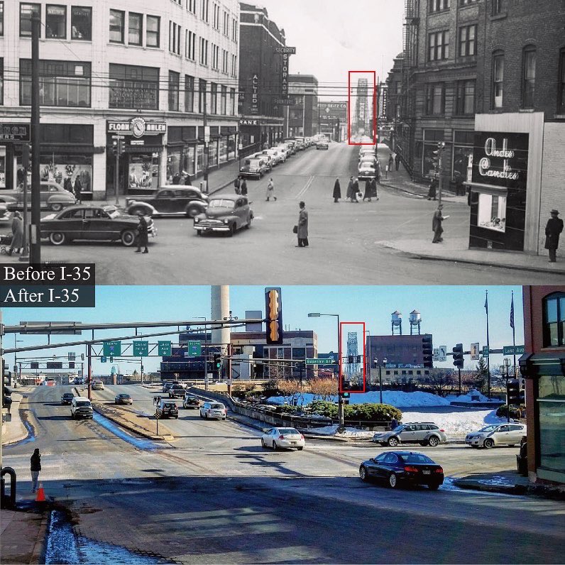
A friend let me know that Duluth recently appeared on Twitter’s Cars.Destroyed.Our.Cities (you might need to log in to see the Tweet; Twitter is undergoing some changes), an account that shows how the addition or removal of car infrastructure can dramatically change the urban environment.
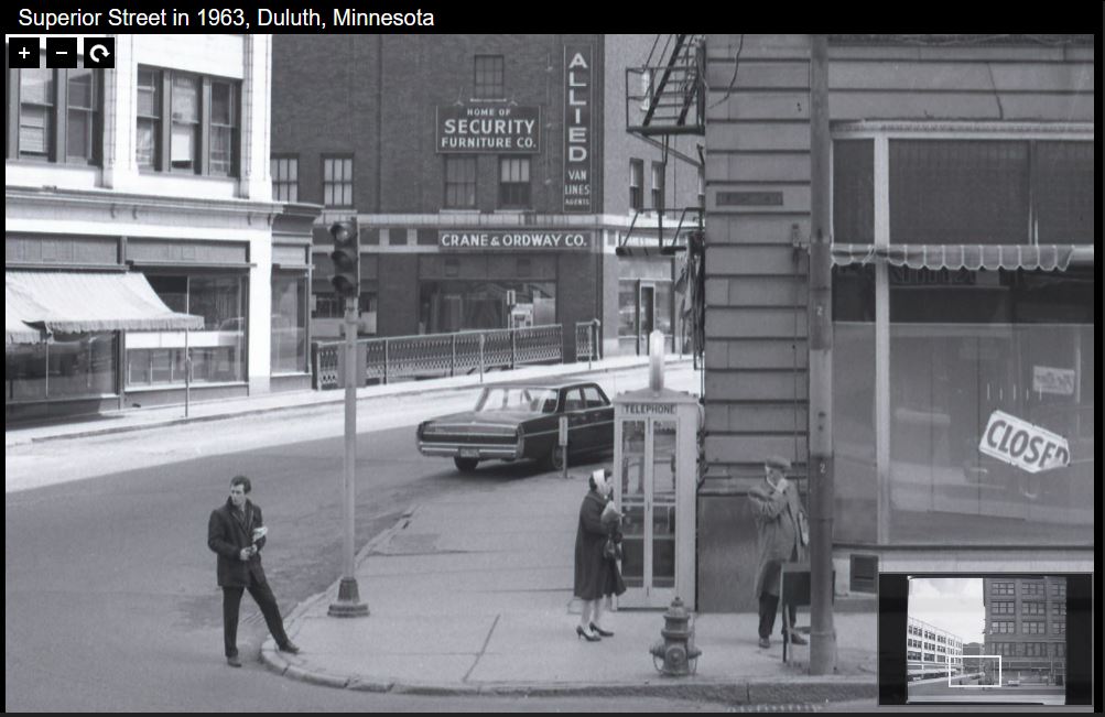
Because train tracks separated downtown from Canal Park long before the construction of I-35, I first thought that the before photo involved a perceptual trick and was taken much closer to the bridge than the after photo. But a photo on Minnesota Reflections shows how the street was kept level with traffic passing underneath at various points, creating a rather seamless integration of Canal Park and Downtown.
The older Twitter photo (and the one above) shows the Bradley Building on the left (demolished in 1979 for the construction of I-35) and Freimuth’s Department Store on the right (torn down in 1968). These two buildings used to be on opposite sides of Lake Avenue on Superior Street, so the two photos shown on Twitter are from the same location.
Of course the construction of I-35 through Duluth in the 1960s and ’70s was highly contested and the original plan would have made a considerably larger impact on downtown and the lakefront.
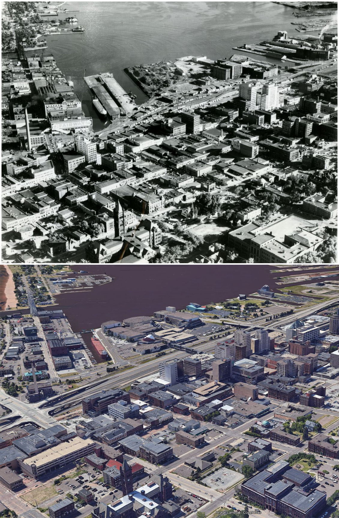
The image below compares an aerial photo of the location from around 1950 with a current Google Earth image from the same perspective, allowing you to evaluate on your own the degree to which cars destroyed Duluth.
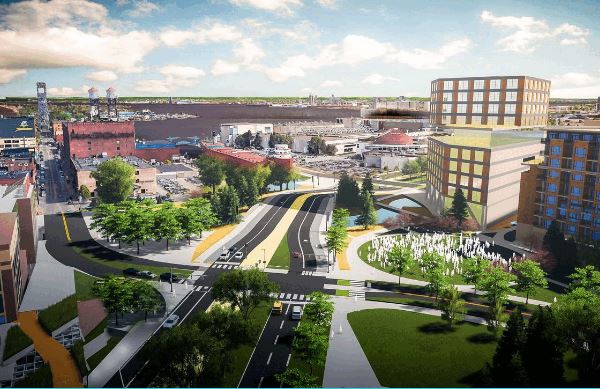
Regardless of what happened in the past, if the plans of the Duluth Waterfront Collective are followed through on, perhaps by the time of PDD’s 40th birthday the After that we have now will have become the Before that we can hardly believe was once how things were.