Google updates satellite view, old things found in Duluth

Jay Cooke

In general I’m not too pleased with the new Google Maps, but the satellite view was very recently updated — with images from possibly just a few weeks ago — which is pleasing because there was no greenery, so you can more easily spot hidden gems that would normally be obscured from view in a more summer-like setting. Here are some of the things I’ve found and rediscovered:

Half an old railroad trestle in Jay Cooke State Park.
Ruins of old homes in Duluth.
An old abandoned road near Arrowhead Road.
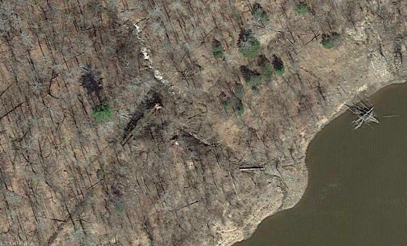
A long abandoned logging railroad bed near the Duluth International Airport.

Note: on Internet Explorer, it activated some 3-D feature with the older satellite view and crude 3-D layout, not sure how to turn it off.

7 Comments

Rae

about 9 years ago

Is there date stamping on the satellite views like there is on street view?  The Observation Hill area is from last summer, at least.

DECk37

about 9 years ago

I don't think there is a way unfortunately, but Observation Hill is under the updated imagery, most of the region is. What you may be seeing is either their horrible 3D Earth View mode, which cannot be turned off apparently, or you're using classic mode, (which I thought already went away), in which when you zoom in far enough, it goes into the 45 degree angle view, (one of the many missing features in the new maps), which can be turned off in the upper right hand corner of the map.

I'm using Chrome, (ironically enough), I don't have Earth View, yet I don't seem to be in Lite Mode either, as I have the other full features they list, just none of that ugly 3D Earth View mode. Both Internet Explorer and Firefox jump right into EarthView mode, so if that's the case, try Lite Mode and/or Classic Mode: https://www.google.com/maps?output=classi Or try the Chrome browser.

I attached an example of Observation hill via Chrome (Left) and Internet Explore (Right).

Rae

about 9 years ago

Interesting - I was using Chrome the whole time, but didn't have the option to turn off the 45 degree tilt (there was no drop down menu in the upper right) until I went to the classic link you provided.  Once I turned it off I could see the changes you had mentioned.   I can't say I'm much a fan of the new imagery, it's the antithesis of lush landscape, which isn't very alluring.

The strange thing is, when I looked at Observation Park it was showing me old imagery, but when I used the same session and viewed a location in Douglas County, it was showing the new imagery.  I feel like I'm my mother trying to use the internet, and nothing is working.

Thank you for your technical help, it was very helpful and appreciated.

Karasu

about 9 years ago

I've seen that road alongside Rice Lake road through the trees, and have thought about trying to get to it. Now I see it doesn't go anywhere, so I guess I won't bother. I wonder if it was an old routing of Rice Lake or just a random roadbed?

DECk37

about 9 years ago

It was the original Rice Lake Road, it was fully connected in the 1948 aerial shot. Note the circle around the intersection, I wonder if they were planning to change the layout way back then.

hbh1

about 9 years ago

I once received a question on Zenith City about changes in routing of Rice Lake Rd., along with a big curve that look counter-intuitive (the asker wanted to know whether a landowner had refused to grant right of way). I tracked down the correct road planning nerd at the County and was told it was strictly about finding the proper road bed. Some of the old track was on unstable/swampy ground, apparently.

DECk37

about 9 years ago

I can definitely see the swampy situation that may have caused the change, thanks in part it would seem to Chester Creek,  there's water surrounding the old road in many places. 

A lot of old roads were also rerouted for safety reasons. It seems back in the day, they didn't think much on how roads met each other, often with crazy intersections, or merging at sharp angles. I suspect this might also have been part of the reason, along with the swampy land, to change up the intersection.

Leave a Comment

Only registered members can post a comment , Login / Register Here

Do NOT follow this link or you will be banned from the site!
Read previous post:
As far as having to clear a windshield in May goes, not so bad

Close